
America Was Built to Move
From colonial roads to the 47,000-mile Interstate Highway System, transportation investments have connected communities, expanded opportunity, strengthened national defense, improved safety, and fueled growth. They transformed a young nation of 13 states into the world's most dynamic economy.
While thousands of projects from coast to coast have contributed to America’s progress, the 250 featured here illustrate a timeless lesson: strategic infrastructure investment pays dividends for generations.
As we celebrate the nation's achievements since 1776, we are reminded our story is still being written. Investments made today, and in the years ahead, will help define our next 250 years.
National Frameworks
The Interstate Highway System
Nationwide
Authorized 1956

The backbone of modern American mobility.
Spanning 47,000 miles and one of the greatest public works projects in history, the Interstate Highway System transformed America by connecting cities, ports, airports, and industries through a seamless national transportation network. It revolutionized personal travel and freight movement, sparked economic growth, strengthened national defense, and remains the backbone of U.S. commerce.
Transcontinental Railroad
Nebraska to California
Est. 1869
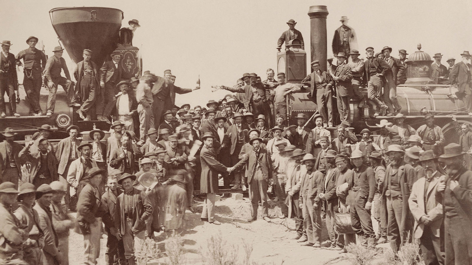
A steel pathway across a growing nation.
Completed with the driving of the Golden Spike at Promontory Summit, Utah, the railroad reduced coast to coast travel time from months to about one week, thereby opening the American West to settlement and commerce, and creating a truly national transportation network. Its impacts on 19th century America are comparable to the 20th century impacts of the Interstates.
Erie Canal
Upstate New York
Est. 1825
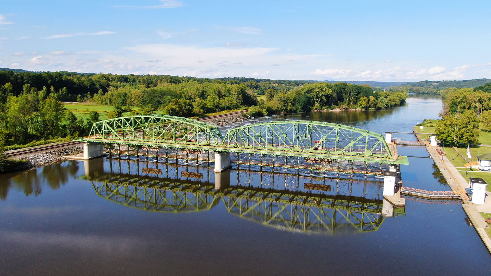
A man-made waterway that unlocked the nation's interior to the world.
Opened in 1825, connected the Great Lakes to the Atlantic, transforming U.S. trade and establishing a major national commerce route.
Amtrak Northeast Corridor
Boston, MA to Washington, D.C.
Est. 1971
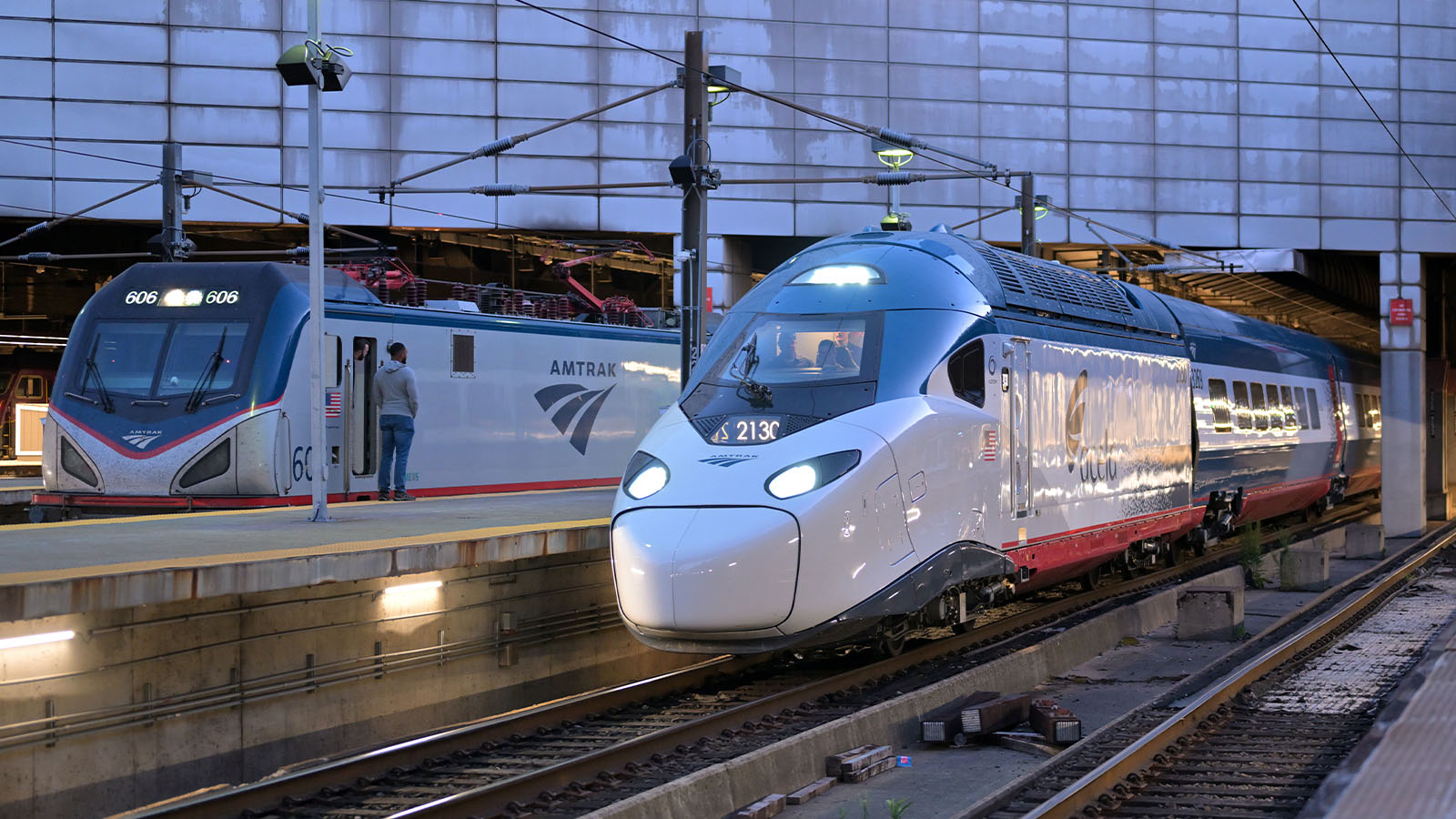
A rail system at the heart of America’s busiest region
The nation’s busiest passenger rail corridor, the modern Northeast Corridor (NEC) moves more people between major East Coast cities than all airlines combined on certain segments. It anchors the economic, political, and cultural connectivity of the Northeast megaregion, and serves as the backbone of America’s intercity and commuter rail networks.
Photo: 4300streetcar, CC BY 4.0, via Wikimedia Commons (cropped)
National Road
Cumberland, MD, Spreading Westward
Est. 1818
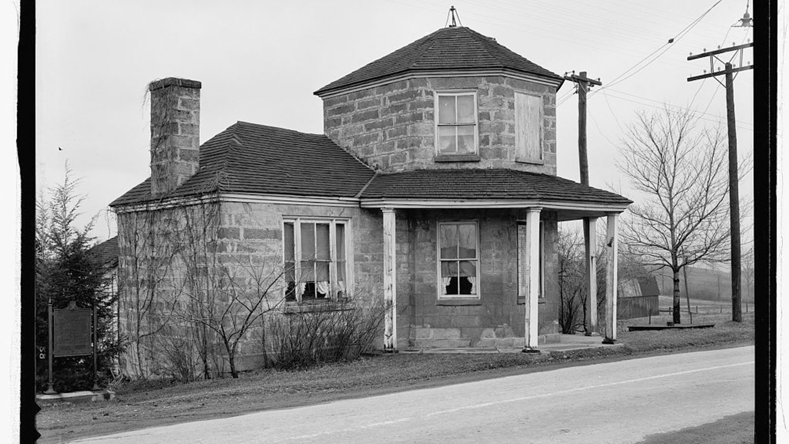
The young nation’s first great push westward, one mile at a time.
Covering more than 600 miles and running from Maryland to Illinois, it was America’s first federally funded interstate highway and provided a young nation with the first reliable overland route to the western frontier, facilitating migration, commerce, military movement, and mail delivery.
American Icons
Instantly recognizable landmarks that combine bold design with everyday function, shaping skylines and connecting communities.
Golden Gate Bridge
San Francisco, CA
Est. 1937
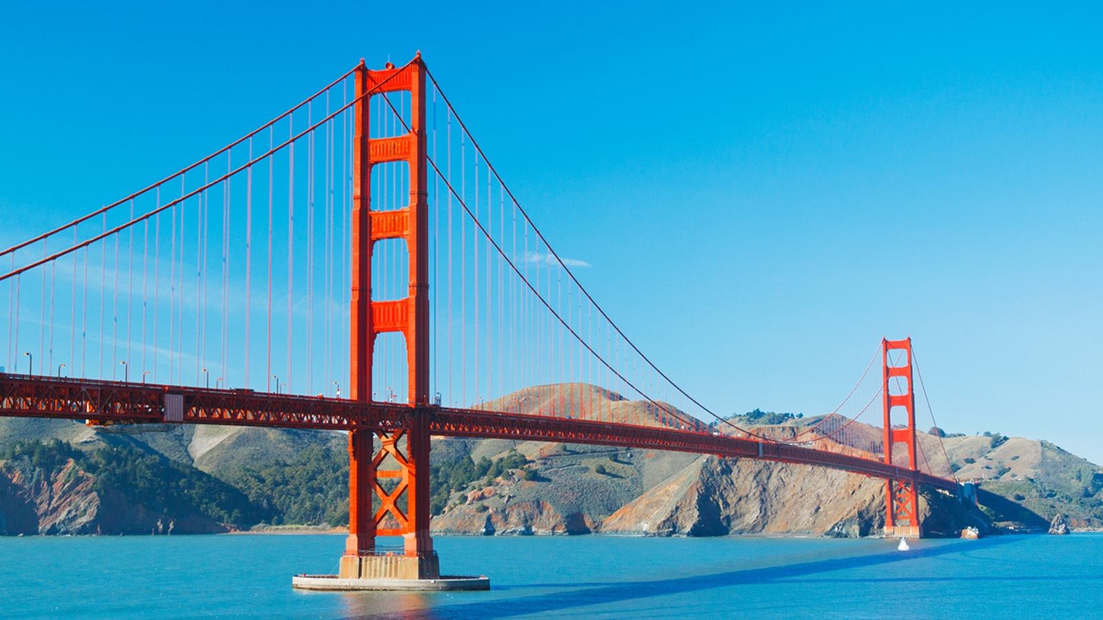
An icon of ambition—and a gateway to opportunity.
Once the longest and tallest suspension bridge in the world, the bridge spanning the Golden Gate Strait carries approximately 40 million passengers annually and generates over $161 million in toll revenue annually.
Brooklyn Bridge
New York, NY
Est. 1883
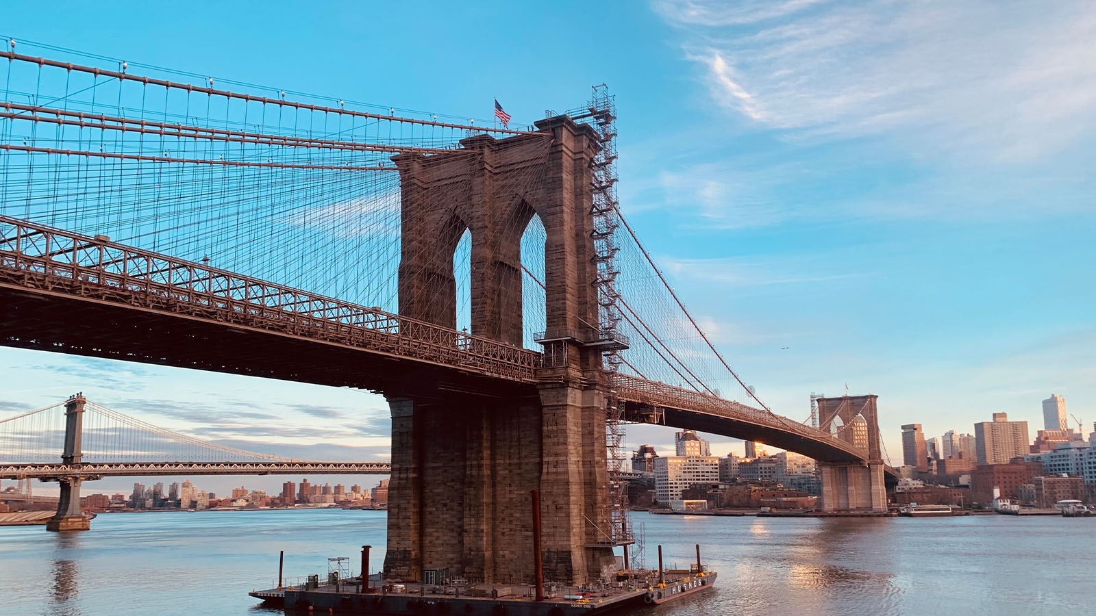
Where innovation met ambition in the Empire City.
An engineering feat and iconic landmark, the bridge served as critical early link to the city’s developing transportation system, accelerated economic growth and established New York as a premier global commercial hub.
Arlington Memorial Bridge
District of Columbia
Est. 1932
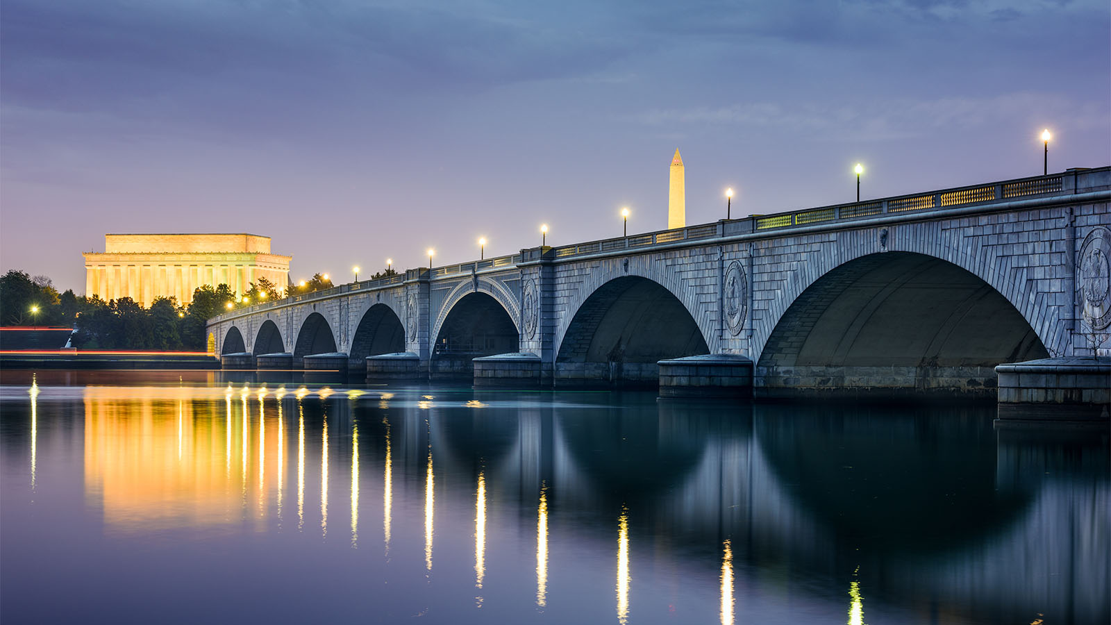
Bridging the capital’s most symbolic spaces
First opened in 1932, the iconic structure is a monument to the sacrifices and valor of our nation’s military personnel and a symbolic link between north and south, while also serving a key commuting corridor across the Potomac River.
Chicago "L" System
Chicago, IL
Est. 1892
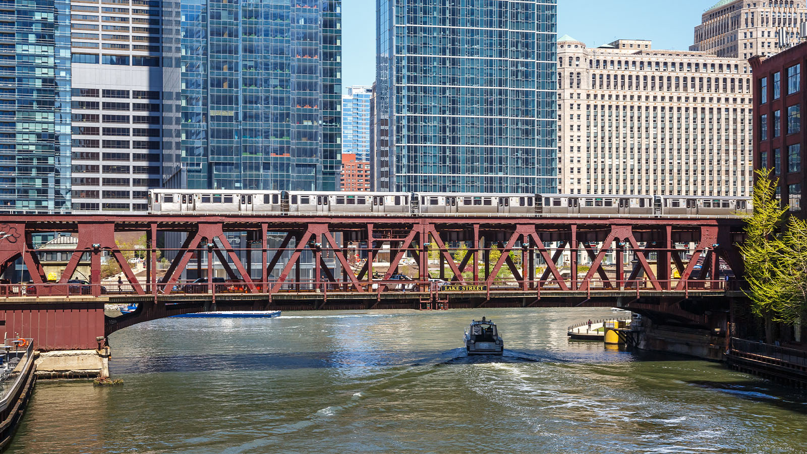
Elevated tracks that shaped the rhythm and growth of a great city.
One of the oldest and most iconic rapid U.S. transit systems, the “L,” now managed by the Chicago Transit Authority, facilitated dense urban growth, supported the Loop as a global commercial center, and today continues to provide essential mobility via 146 stations to more than 138 million riders annually.
Grand Central Terminal
New York, NY
Est. 1913
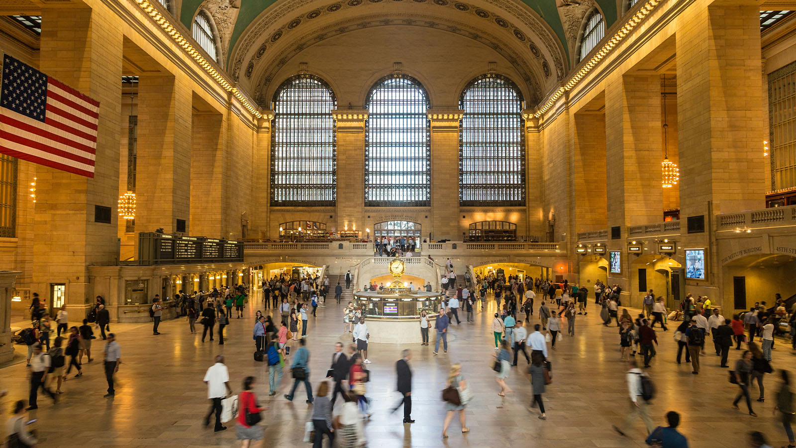
The beating heart of a city in motion.
The terminal transformed transportation and development in the city by creating one of the world's largest and most efficient passenger rail hubs. It has served tens of millions of travelers for more than a century and remains one of the most iconic transportation facilities.
Economic Engines
Critical hubs moving goods and people at massive scale, fueling jobs, trade, and the daily rhythms of American life.
Port of Los Angeles
Los Angeles, CA
Est. 1907
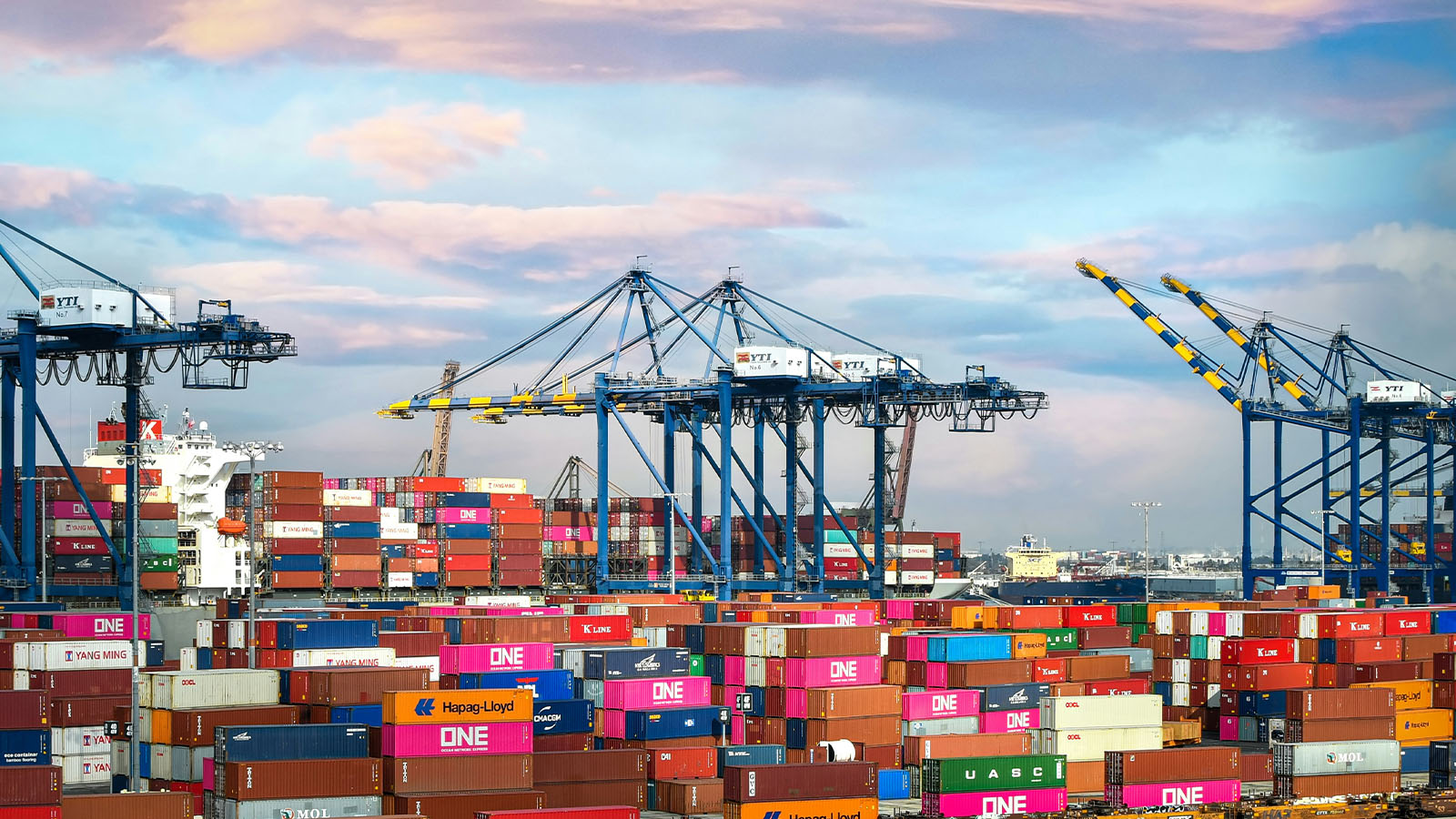
At the center of global trade—and a driving force of the American economy.
The nation's busiest container port for 26 consecutive years, it handles over $300 billion in cargo annually, supports more than 1 million U.S. jobs, and serves as the leading gateway for international trade in the Western Hemisphere.
Hartsfield–Jackson Atlanta International Airport
Atlanta, GA
Est. 1926
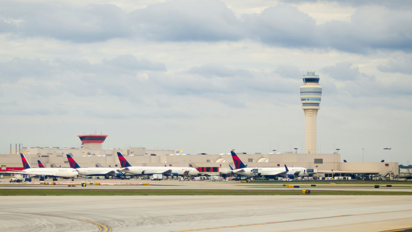
Where millions of journeys converge at the center of global air travel.
Supported Atlanta’s rise as the world’s busiest passenger airport, today having a $66 billion annual economic impact and providing more than 63,000 jobs onsite.
New Jersey Turnpike
New Jersey
Est. 1951
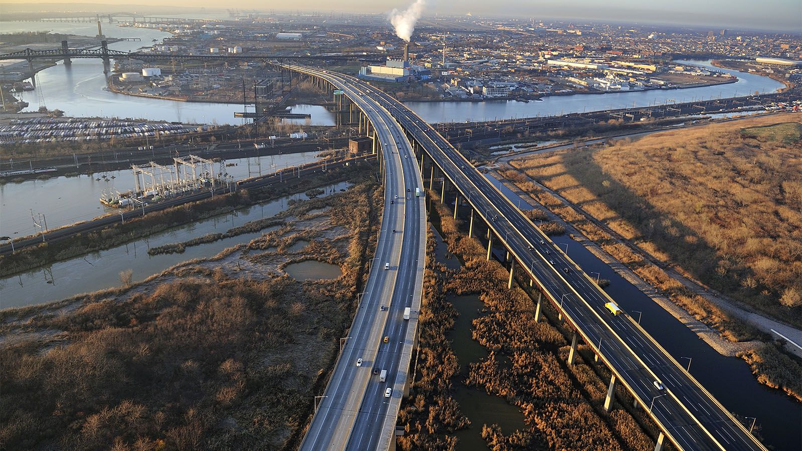
A critical artery moving people and goods through the nation’s busiest corridor.
The state’s first modern-day toll road became a critical freight artery and passenger vehicle route for the Northeast Corridor.
Ambassador Bridge
Detroit, MI to Windsor, Ontario
Est. 1929
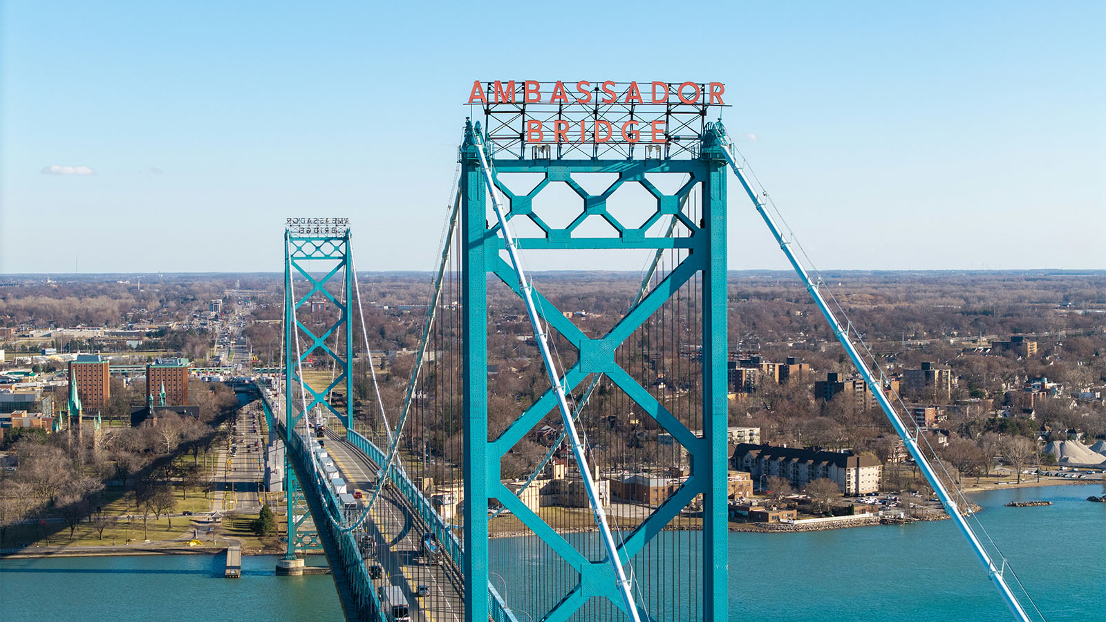
A crucial linchpin of cross-border commerce.
One of North America’s busiest border crossings, supporting U.S.–Canada automotive and agricultural trade.
Pennsylvania Turnpike
Pennsylvania
Est. 1940
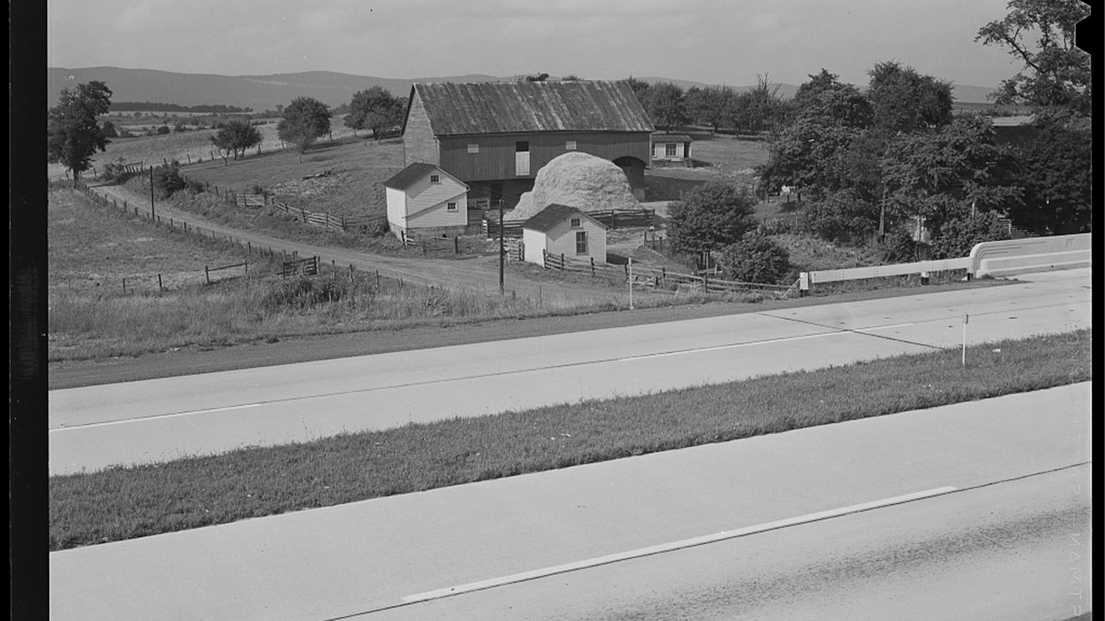
The prototype for America’s highway network.
Stretching from the Harrisburg to near Pittsburgh, the Pennsylvania Turnpike became America’s first major superhighway and model for the Interstate System.
Scenic Routes
Routes that connect communities with the landscapes and heritage that define them. These corridors support tourism, regional economies, and the experiences that make travel meaningful.
Route 66
Chicago, IL to Santa Monica, CA
Est. 1926
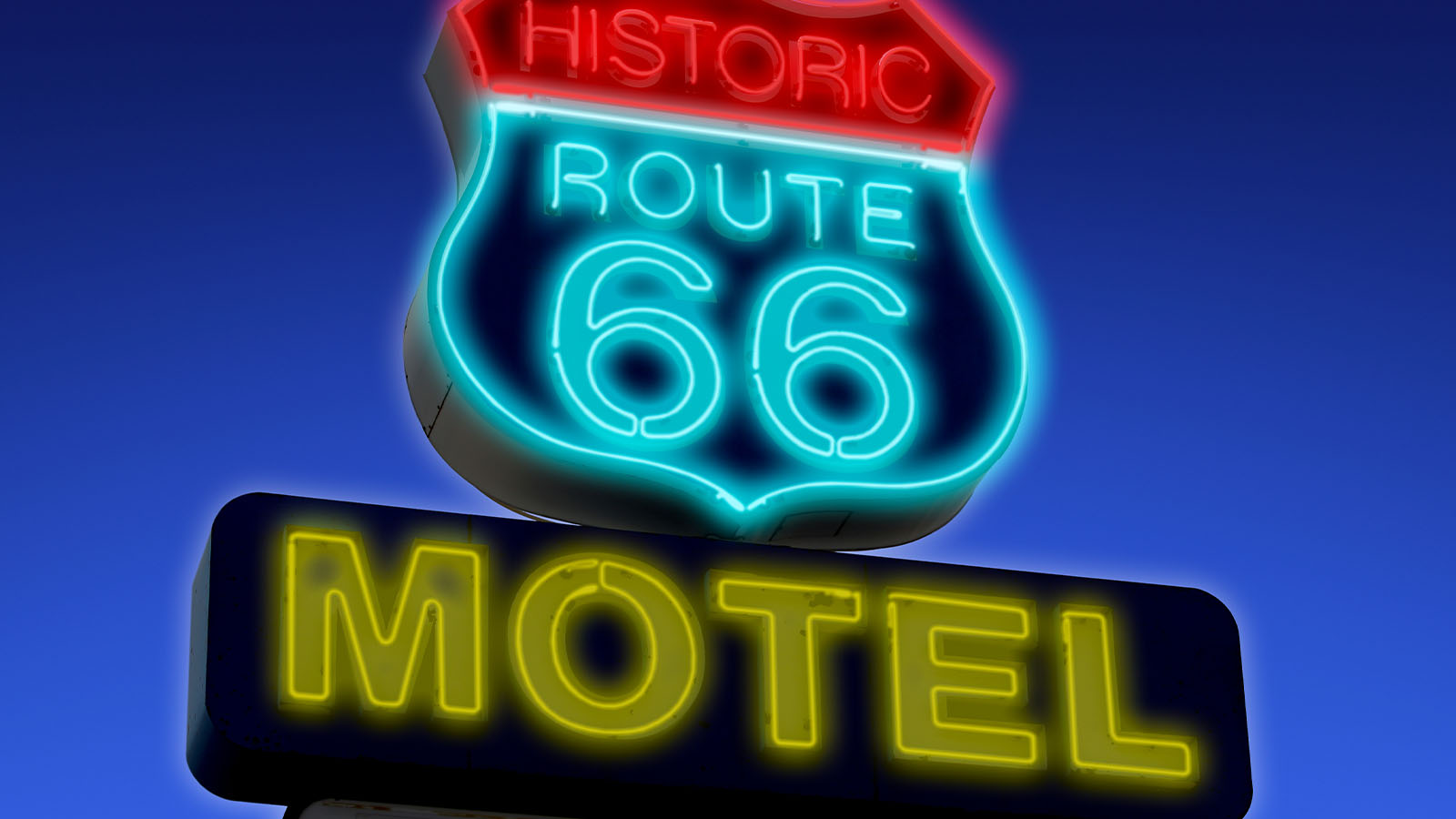
The highway that carried a nation west—and into a new era of mobility
Established one of the nation’s first continuous cross-country highways, enabling long-distance travel, supporting westward migration, and shaping the nation’s early automotive economy.
Blue Ridge Parkway
North Carolina, Virginia
Est. 1939
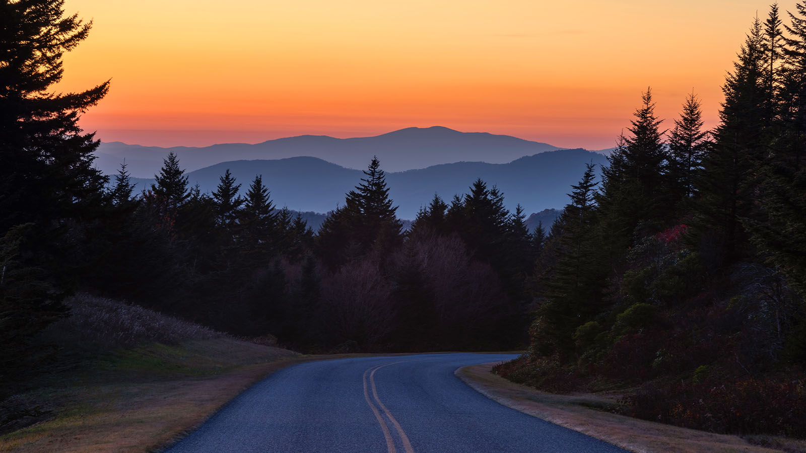
A scenic route designed for the journey as much as the destination.
Created the first national rural parkway designed for leisurely drives, it offered easy access to stunning views of the central and southern Appalachian landscapes. In 2024, more than 16.5 million visitors spent an estimated $1.3 billion at local attractions while traveling the parkway.
Florida Overseas Highway
Key Largo to Key West, FL
Est. 1928
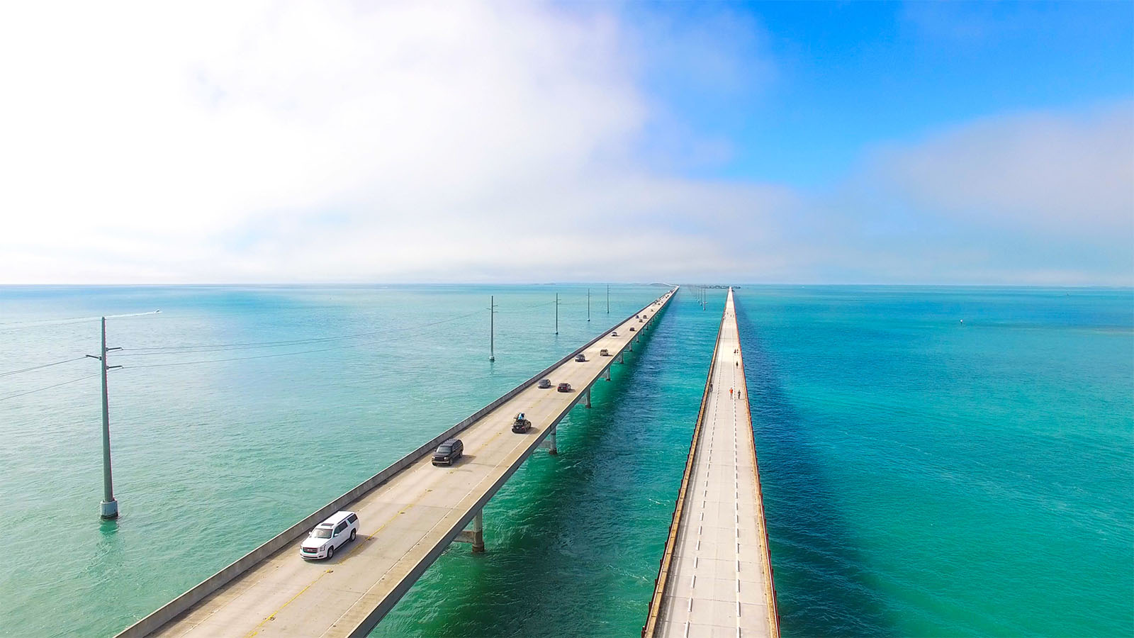
Needles threaded between open ocean and blue sky.
113 miles of roadway from Key Largo to Key West, it incorporates 42 bridges leapfrogging from key to key in a series of giant arches of concrete and steel over the open waters of the Atlantic Ocean, Florida Bay and the Gulf of Mexico.
Eisenhower–Johnson Memorial Tunnels
Colorado (I‑70)
Est. 1973
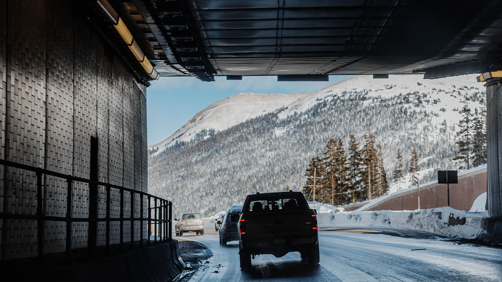
Cutting through the Continental Divide to keep the West connected year-round.
Enabled year-round safer travel of people and goods across the Continental Divide and boosted tourism.
Yellowstone National Park Road System
Idaho, Montana, Wyoming
Est. 1906
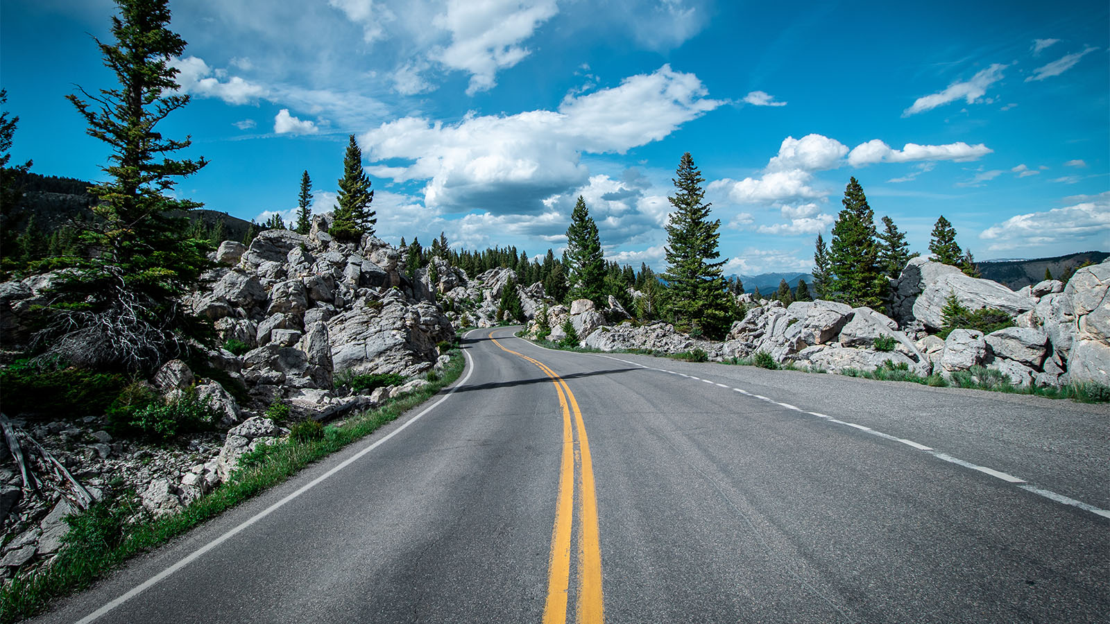
Opening America’s first national park to generations of visitors.
Enabled national tourism access to America’s first national park. It helped establish the model for scenic road travel and federal investment in park infrastructure, making remote natural landscapes accessible to the public while shaping early conservation policy.
Innovation in Action
Pioneering projects that introduced new techniques, set benchmarks, and helped establish the systems we rely on today.
Chesapeake Bay Bridge-Tunnel
Virginia
Est. 1964
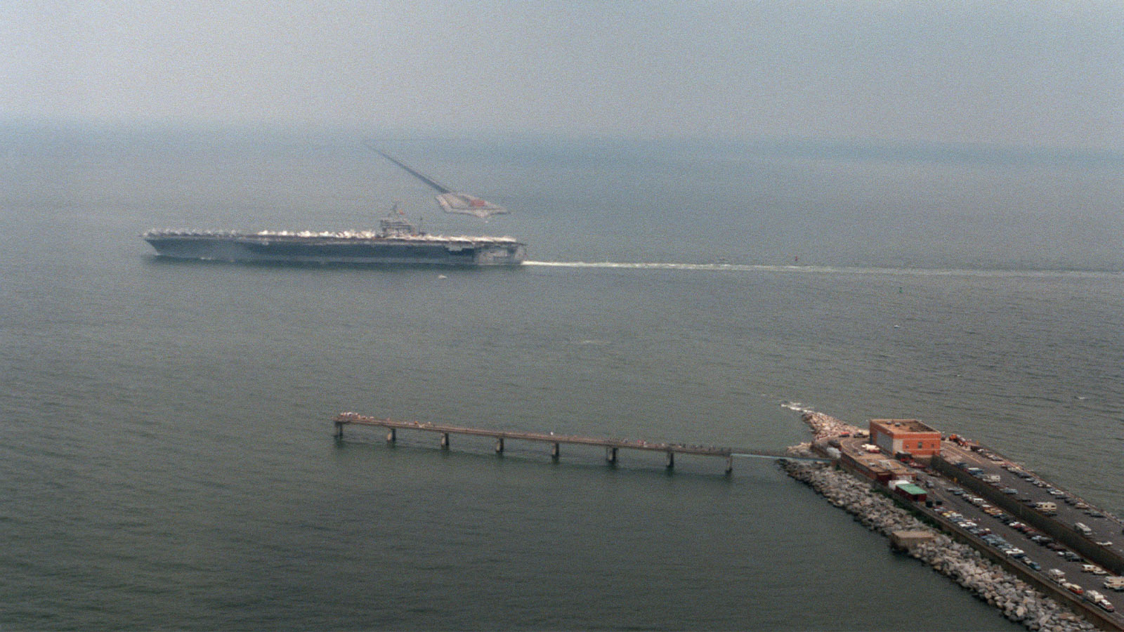
Seventeen miles of bridge and tunnel transforming hours into minutes.
The only fixed link between the Delmarva Peninsula and Hampton Roads, cutting travel times from several hours to 23 minutes and serving as a critical corridor for Eastern Shore agriculture, commerce, and tourism.
Lake Pontchartrain Causeway
Mandeville–Metairie, LA
Est. 1856
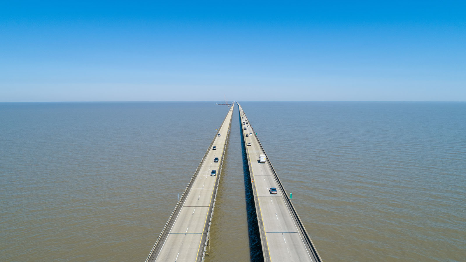
One of the longest bridges on Earth, spanning water as far as the eye can see.
Created a critical north-south commuter and freight link across Lake Pontchartrain, strengthening regional economic integration. Largest continuous bridge over a body of water in the world.
Grand Coulee Dam
Washington State
Est. 1941–1943
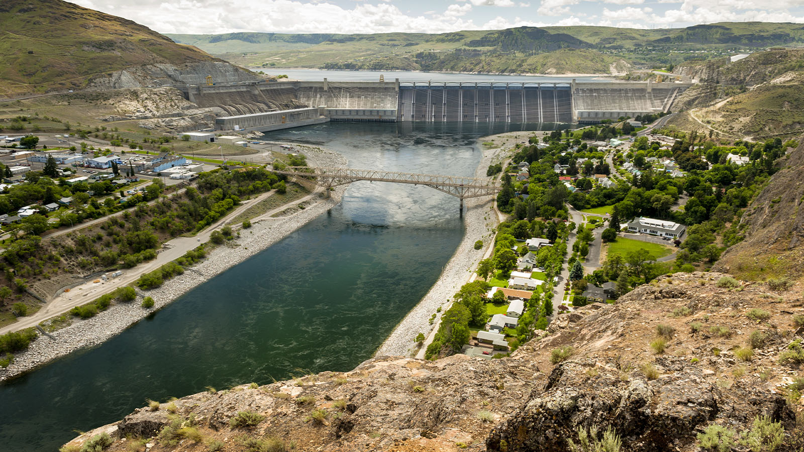
Harnessing one of America’s great rivers to power the modern West.
The largest hydropower producer in the U.S., generating over 21 billion kilowatt-hours annually to supply electricity across eight western states, supporting $1.2 billion in irrigated agriculture and preventing over $206 million in flood damages since 1950.
Hoover Dam Bypass Bridge
(Mike O'Callaghan–Pat Tillman Memorial Bridge)
Hoover Dam, Nevada/Arizona Stateline
Est. 2010
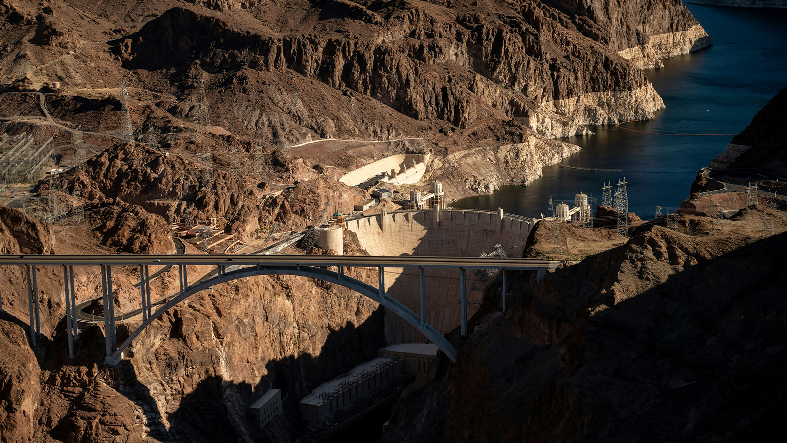
Reimagining a vital route for safety and efficiency.
The four-lane bridge, soaring nearly 90 stories above the Colorado River, eliminated the narrow switchbacks and low travel speeds that had long plagued U.S. 93 crossing the Hoover Dam. It also helped to remove commercial, high-volume traffic from the dam as a key post-9/11 safety measure.
Bellefontaine’s Court Avenue
Bellefontaine, OH
Est. 1893
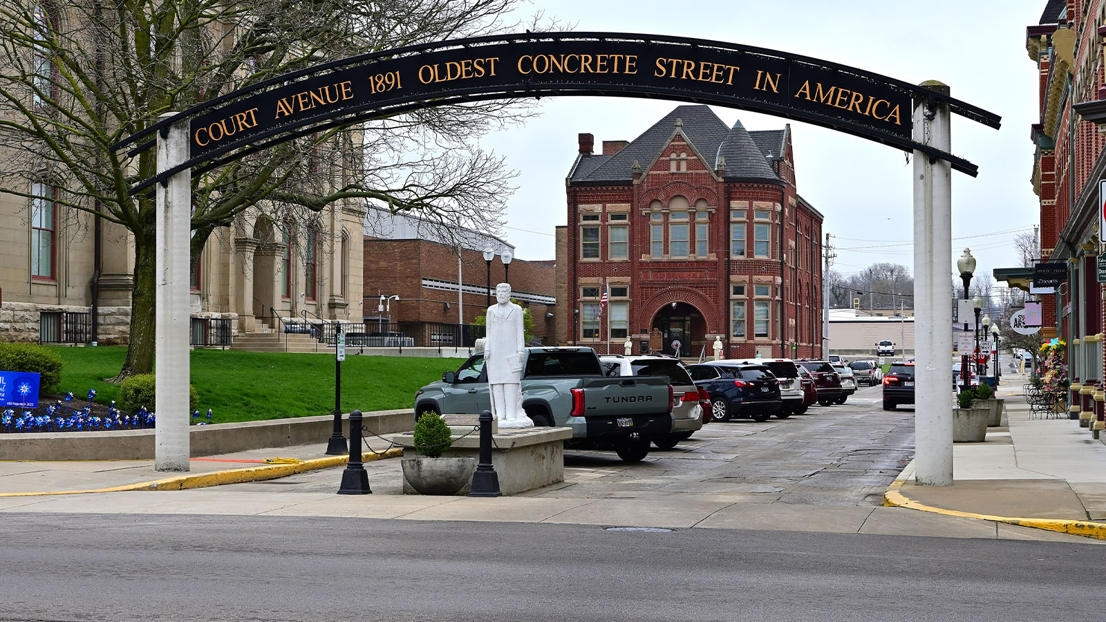
The nation’s first concrete street—and the beginning of modern pavement.
First concrete-paved street in U.S.; won innovation prize at Chicago World's Fair.
Photo: Andrew Heneen, CC BY 4.0, via Wikimedia Commons (cropped)
The Modes
From roads and bridges to ports, railways, airports, and waterways, each mode plays a distinct role in moving people and goods. This video series explores the infrastructure that keeps America connected.
The Road Home

Transit

The Crossing

The Story is Still Being Written
The decisions made today will shape our next 250 years. America’s transportation network didn’t happen by accident. It was built through the commitment of individuals like you. Receive our weekly newsletter to stay engaged and be a part of the next chapter.
250 Transportation Projects
That Helped Build America
Discover transportation projects that have connected communities, strengthened the economy, and shaped the American experience.
| State | Project | Mode | Location | Opened | Impact |
|---|---|---|---|---|---|
| National | U.S. Interstate Highway System | Highway & Streets | Across America | 1950s-1990s | 47,000 miles, backbone of U.S. commerce, connecting cities, ports, and industries while transforming travel, freight, and national defense. |
| National | National Road (Cumberland Road) | Highway & Streets | Cumberland, Md. and spread west | 1811-1830s | 600+ miles, first federally funded interstate highway, enabling migration, commerce, and overland travel to the western frontier. |
| National | Transcontinental Railroad | Rail & Transit | Nebraska to California. Connections linked the line to eastern railroads serving the rest of the country. | 1869 | Reduced coast-to-coast travel to one week, opening the West to settlement and creating a national transportation network. |
| National | Lincoln Highway | Highway & Streets | Stretched from New York to California. | 1913 | Spanning 3,100 miles through 13 states from New York to California, it became the first “Main Street America,” transforming auto travel and tourism while shaping the future Interstate system. |
| Alabama | Mobile River/Cochrane-Africatown USA Bridge | Bridge & Tunnel | Mobile | 1991 | Improved freight mobility to the Port of Mobile and enhanced maritime clearance as Alabama’s first cable-stayed bridge. |
| Alabama | Port of Mobile | Ports & Waterway | Mobile | Late 1920s | $100B economic impact, 351,000 jobs supported, serving as Alabama’s primary engine connecting the state to global markets. |
| Alabama | Bankhead Tunnel | Bridge & Tunnel | Connects Mobile with Blakeley Island | 1941 | 3,390‑foot tunnel built in sections and sunk into place, carrying 15,000 vehicles daily and serving as a key Mobile connection. |
| Alabama | Tennessee-Tombigbee Waterway | Ports & Waterway | Alabama and Mississippi | 1984 | 234‑mile waterway linking Tennessee and Tombigbee rivers, connecting Gulf trade routes and cutting hundreds of miles from shipping. |
| Alabama | Jubilee Parkway & George Wallace Tunnel | Bridge & Tunnel | Mobile | 1978 | Carries I‑10 traffic across Mobile Bay, serving as a key regional route with major expansion planned to meet future demand. |
| Alaska | Alaska Highway (U.S. Segment) | Highway & Streets | Begins at junction by Dawson Creek, British Columbia and runs to Delta Junction | 1948 | Connected Alaska to the Lower 48, enabling military logistics and access to natural resources through a critical overland route. |
| Alaska | Alaska Marine Highway System | Ports & Waterway | Covers 3,500 miles of coastline providing service to over 30 communities that stretch from Bellingham, Wash., to Dutch Harbor in the Aleutian Chain | 1963 | Serves 30+ communities across 3,500 miles, moving people, goods, and vehicles while supporting economic access and quality of life. |
| Alaska | Trans-Alaska Pipeline System (TAPS) | Pipeline | Prudhoe Bay to Valdez | 1977 | 800+ mile pipeline transporting North Slope oil, opening domestic energy supply and transforming Alaska’s economy and engineering. |
| Alaska | Anton Anderson Memorial Tunnel | Bridge & Tunnel | Whittier | 1943 | 2.5‑mile tunnel, longest highway tunnel in North America, sharing rail traffic with alternating one-lane vehicle flow every 30 minutes. |
| Alaska | Ted Stevens Anchorage International Airport | Airports | Anchorage | 1951 | 3rd-largest cargo airport globally and largest in Western Hemisphere, anchoring global freight flows since 1951 with strategic trans-Pacific reach. |
| Arizona | Douglas Municipal Airport | Airports | Douglas | 1928 | Opened 1928, recognized in 1933 by Eleanor Roosevelt as the first U.S. international airport, marking early cross-border aviation history. |
| Arizona | Phoenix Sky Harbor International Airport | Airports | Phoenix | 1952 | 52M passengers yearly, $44B economic impact, 47,000 jobs supported—one of the nation’s busiest and most economically significant airports. |
| Arkansas | Hernando de Soto Bridge (I-40 Mississippi River Crossing) | Bridge & Tunnel | Connects Memphis, Tenn., to West Memphis, Ark. | 1973 | Called the "M Bridge" for its shape, it serves as a crucial I‑40 Mississippi River crossing supporting major freight and passenger traffic. |
| Arkansas | McClellan-Kerr Arkansas River Navigation System | Ports & Waterway | 445-mile channel crosses Arkansas into Oklahoma | 1971 | 445‑mile navigation system enabling barge shipping, reducing freight costs, and supporting agriculture, energy, and manufacturing. |
| California | Alameda County Boundary to Richmond Road (California Federal-Aid Road Project No. 3) | Highway & Streets | A 2.5 mile segment from Albany at the Alameda County line north to Richmond in Contra Costa County | 1918 | 2.5‑mile road completed in 1918, first federal-aid highway project, launching the federal-state partnership shaping U.S. roadbuilding. |
| California | San Francisco International Airport | Airports | A roughly 14‑mile southward location from downtown San Francisco to an unincorporated San Mateo County site on the San Francisco Peninsula, between Millbrae and San Bruno along the San Francisco Bay | 1920s | 55M passengers yearly, $70B economic impact, 31,000 jobs supported—one of the world’s leading international gateways and economic engines. |
| California | Golden Gate Bridge | Bridge & Tunnel | A 1.7‑mile suspension bridge spanning the Golden Gate strait, linking San Francisco and Marin County | 1937 | 40M+ crossings yearly, $161M+ toll revenue, once the world’s longest and tallest suspension bridge, serving as a vital Bay Area link. |
| California | Bay Area Rapid Transit | Rail & Transit | A regional rail transit system spanning the San Francisco Bay Area, linking San Francisco with Oakland and surrounding cities across five counties, including Alameda and Contra Costa | 1972 | 131‑mile rail system with 50 stations, serving as the backbone of Bay Area transit connecting San Francisco with East Bay and Peninsula communities. |
| California | Sixth Street Viaduct Replacement (City of Los Angeles) | Ports & Waterway | Spanning the Los Angeles River just east of downtown, it connects the Arts District with the Boyle Heights neighborhood | 2022 | 3,500‑foot viaduct restoring a key Los Angeles River crossing, improving safety and mobility for vehicles, pedestrians, and cyclists while boosting redevelopment. |
| California | Los Angeles International Airport | Airports | Los Angeles | 1928 | 74M passengers yearly, nearly $127B economic output—one of the world’s busiest international gateways and a major driver of global and regional economy. |
| California | San Francisco-Oakland Bay Bridge | Bridge & Tunnel | Crossing the San Francisco Bay, the bridge links downtown San Francisco on the western shore with Oakland and the East Bay on the eastern side | 1936 | 43M vehicles yearly, serving as a vital corridor linking San Francisco and the East Bay, supporting regional mobility and economic activity. |
| California | Highway 1 | Highway & Streets | Runs along the coastline from south to north, connecting major cities and scenic regions along the Pacific Ocean | 1919-late 1930s | 650+ mile coastal highway, connecting communities and supporting tourism along scenic routes like Big Sur across California’s Pacific coast. |
| California | U.S. Route 101 | Highway & Streets | A 1,535-mile highway running along the Pacific Coast from Los Angeles, Calif., north through Oregon and Washington to Tumwater, Wash. | 1926 | 1,535‑mile highway linking Los Angeles, the Bay Area, and the Pacific Northwest, serving as a major freight, passenger, and tourism corridor. |
| California | Ports of Los Angeles | Ports & Waterway | Located in San Pedro Bay, 25 miles south of downtown | 1907 | $300B+ annual cargo, 1M+ jobs supported, nation’s busiest container port, serving as the leading Western Hemisphere gateway for global trade. |
| California | Port of Long Beach | Ports & Waterway | Long Beach | 1911 | Premier U.S. gateway for trans-Pacific trade, it handles $300 billion in trade annually and supports 2.7 million U.S. jobs, including 1.6 million in California. |
| California | Yosemite Regional Transportation System | Rail & Transit | Yosemite National Park | 2000 | Spans 480 square miles, providing transit access throughout Yosemite and connecting visitors to key destinations across the park and surrounding region. |
| California | SR 91 Express Lanes | Highway & Streets | Orange County | 1995 | First fully automated tolled lanes in the U.S., launched as a public-private partnership to improve traffic flow and corridor efficiency. |
| Colorado | Denver International Airport | Airports | Denver | 1995 | 82M+ passengers yearly, $47.2B economic impact—one of the nation’s largest and busiest aviation hubs, driving major economic growth and connectivity. |
| Colorado | Eisenhower-Johnson Memorial Tunnels | Highway & Streets | Arapaho National Forest on Interstate 70; 60 miles west of Denver | 1973 | Enabled safer year-round travel across the Continental Divide, supporting movement of people and goods while boosting tourism. |
| Colorado | Royal Gorge Bridge | Pedestrian Bridge | Spans the Royal Gorge of the Arkansas River near Cañon City—America’s highest suspension bridge | 1929 | America’s highest suspension bridge, became an engineering landmark and major tourism driver supporting jobs and economic activity. |
| Colorado | Glenwood Canyon Project | Highway & Streets | Between Glenwood Springs and Dotsero | 1992 | Four-lane I‑70 corridor through Glenwood Canyon, improving safety and mobility while integrating with the Colorado River and natural landscape. |
| Connecticut | Merritt Parkway | Highway & Streets | 37.5 miles between the NY State Line in Greenwich and the Housatonic River in Stratford | 1940 | 37.5‑mile parkway, first divided limited-access highway in Connecticut, listed on the National Historic Register and serving 80,000 vehicles daily. |
| Connecticut | The Bulkeley Bridge | Bridge & Tunnel | Carries I-84, US-6, and US-44 over the Connecticut River in Hartford | 1908 | One of the oldest bridges in the Interstate system, once the world’s largest stone arch bridge, carrying major highways over the Connecticut River. |
| Connecticut | The New Haven Rail Line | Rail & Transit | 72+ mile commuter rail line operating between New Haven and Grand Central Terminal | 1849 | 72+ mile rail line serving 30M+ passengers yearly, connecting New Haven to NYC and supporting regional commuting and economic activity. |
| Connecticut | CTFastrak | Rail & Transit | Hartford to New Britain | 2015 | Bus rapid transit system using former rail right-of-way, recognized as one of the highest-rated BRT systems in the United States. |
| Delaware | Delaware Memorial Bridge | Bridge & Tunnel | New Castle, Del., and Pennsville, N.J. | 1951 | 100,000+ vehicles daily, strengthening interstate travel between Delaware and New Jersey as a key regional crossing. |
| Delaware | DuPont Highway (U.S. Route 13) | Highway & Streets | Wilmington to Dover to southern Delaware | 1923 | 103‑mile highway improving north-south mobility, agricultural access, and forming a foundation for Delaware’s modern highway network. |
| Delaware | Wilmington Station (Joseph R. Biden, Jr., Railroad Station) | Rail & Transit | Located in downtown, serving Amtrak and Southeastern Pennsylvania Transportation Authority passengers | 1907 | One of the busiest Northeast Corridor stations outside major metros, providing high-speed rail access and supporting regional economic growth. |
| Delaware | Delaware Breakwater | Ports & Waterway | Lewes | 1828 | Provided a safe harbor for Atlantic and Delaware Bay shipping, improving maritime safety and supporting regional commerce. |
| District of Columbia | 14th Street Bridge Complex | Bridge & Tunnel | Runs through Washington, D.C., to Arlington, Va. | 1950-1972 | Most traveled bridge system in D.C., with five spans carrying I‑395 traffic, Metrorail service, and passenger and freight rail across the Potomac. |
| District of Columbia | Arlington Memorial Bridge | Bridge & Tunnel | Runs from Arlington, Va., to Washington, D.C. | 1932 | Opened in 1932, iconic bridge honoring military service while serving as a key commuting link between Arlington and Washington, D.C. |
| District of Columbia | Frederick Douglass Memorial Bridge (Replacement) | Bridge & Tunnel | Anacostia Waterfront | 2017 | Improved multimodal transportation access, increasing community connectivity and supporting economic development across the Anacostia River. |
| District of Columbia | Union Station | Rail & Transit | Washington, D.C. | 1907 | 40M+ visitors yearly, major multimodal hub with 7 transportation modes and 30+ providers connecting regional and national travel in D.C. |
| District of Columbia | Washington Metro | Rail & Transit | Washington, D.C. | 1976 | 98 stations and 128 miles of track, backbone of mobility in the nation’s capital shaping regional growth and daily commuting. |
| Florida | Miami Harbor Deepening & Widening | Ports & Waterway | Miami | 2015 | $61B annual economic impact, deepened to 52 feet and widened to 800 feet, enabling larger vessels and expanding port capacity. |
| Florida | Sunshine Skyway Bridge | Bridge & Tunnel | Across the mouth of Tampa Bay | 1987 | Iconic bridge rebuilt after 1980 collapse, supporting regional travel and tourism across Tampa Bay. |
| Florida | Brightline Florida | Rail & Transit | Miami to Orlando | 2023 | First modern privately operated U.S. intercity rail, expanding mobility between Miami and Orlando and introducing new passenger rail investment. |
| Florida | Alligator Alley | Highway & Streets | Naples on Gulf Coast to Fort Lauderdale on Atlantic | 1968 | 80‑mile roadway linking Gulf and Atlantic coasts, providing a direct east-west route through one of Florida’s most ecologically rich regions. |
| Florida | Seven Mile Bridge | Bridge & Tunnel | Connects Marathon in the Middle Keys to Little Duck Key in the Lower Keys | 1982 | Iconic Florida Keys bridge connecting Marathon to Little Duck Key, supporting transportation, tourism, and regional economic activity. |
| Florida | Florida Overseas Highway | Highway & Streets | Key Largo to Key West | 1928 | 113‑mile highway with 42 bridges connecting Key Largo to Key West, supporting travel and tourism across Florida’s island chain. |
| Florida | Florida East Coast Railway | Rail & Transit | Jacksonville to Key West | late 1800s-early 1900s | Built by Henry Flagler, connected isolated east coast communities and helped transform them into major centers of commerce. |
| Florida | Orlando International Airport | Airports | Orlando | 1975 | 58M passengers yearly, $41B economic impact—4th largest U.S. airport and a major business and tourism gateway. |
| Florida | Miami International Airport | Airports | Miami | 1928 | 56M passengers yearly, $181B business revenue, 843,000 jobs—2nd busiest U.S. airport for international travelers. |
| Georgia | Hartsfield-Jackson Atlanta International Airport | Airports | Atlanta | 1926 | $66B economic impact, 63,000+ onsite jobs—supports the world’s busiest passenger airport and a major global aviation hub. |
| Georgia | Metropolitan Atlanta Rapid Transit Authority (MARTA) | Rail & Transit | Serves the Metropolitan Atlanta Area. | 1979 (rail system), 1972 (agency & bus operations) | 65M+ trips yearly across bus, rail, and streetcar service, providing essential transit across the Atlanta metro region. |
| Georgia | Savannah Harbor Expansion Project | Ports & Waterway | Savannah | 2015-2022 | 47‑foot deep harbor, 5.25M container units annually, expanding capacity and supporting one of the largest container terminals in the Western Hemisphere. |
| Hawaii | Hana Highway | Highway & Streets | Maui | 1926 | 64.4‑mile highway connecting Kahului to Hana, serving as a critical travel route across eastern Maui. |
| Hawaii | Pearl Harbor Naval Base | Ports & Waterway | Honolulu | late 1800s-early 1900s | Major Pacific harbor that transformed Hawaii into a strategic crossroads for military and maritime activity. |
| Hawaii | Interstate H-3 Freeway | Highway & Streets | Honolulu | 1997 | Crosses the Koʻolau Mountains via tunnels and viaducts, providing a critical transportation link across Oahu. |
| Hawaii | Honolulu Skyline | Rail & Transit | Oahu | 2023 | Automated driverless rail system, Hawaii’s first metro, expanding transit options as one of the state’s largest infrastructure projects. |
| Idaho | Goff Bridge | Bridge & Tunnel | Riggins | 1935 | Linked north and south Idaho on US‑95, replaced in 1999, and known as the Time Zone Bridge between Mountain and Pacific zones. |
| Idaho | Perrine Bridge | Bridge & Tunnel | Twin Falls | 1976 | 993‑foot bridge spanning the 486‑foot Snake River Canyon, connecting Twin Falls and Jerome counties. |
| Idaho | Taylor's Bridge | Bridge & Tunnel | Idaho Falls | 1865 | Spanned the Snake River in 1865, creating a key early freight link between Utah and Montana. |
| Idaho | Wallace Viaduct | Highway & Streets | Wallace | 1991 | Completed I‑90 in Idaho, removing the last traffic light between Seattle and Boston and improving freight movement while preserving Wallace. |
| Illinois | Chicago “L” System | Rail & Transit | Chicago | 1892 | 138M+ riders yearly, 146 stations, historic rapid transit system supporting dense urban growth and mobility across Chicago. |
| Illinois | O’Hare International Airport | Airports | Chicago | 1955 | 85M passengers yearly, $45B+ regional economic impact with Midway, serving as one of the world’s busiest aviation hubs and cargo centers. |
| Illinois | Route 66 | Highway & Streets | Starts in Chicago and ends in California. | 1926 | One of the first continuous cross-country highways, enabling long-distance travel, westward migration, and growth of the early automotive economy. |
| Illinois | Rock Island Bridge | Bridge & Tunnel | Rock Island | 1896 | First railroad bridge across the Mississippi, later replaced with a twin-deck structure carrying both rail and road traffic. |
| Indiana | Burns Harbor Port | Ports & Waterway | Burns Harbor | 1965 | $4.63B economic impact, Indiana’s first deepwater public port, continuing to support shipping and industry since 1965. |
| Indiana | Chicago, Indianapolis and Louisville Railway - Monon Railroad | Rail & Transit | Chicago, Indianapolis and Louisville | 1897-1971 | Connected Chicago, Indianapolis, and Louisville, transporting freight and passengers and supporting industry, universities, and regional commerce. |
| Indiana | Michigan Road | Highway & Streets | Ran north-south through the state, connecting Madison on the Ohio River to Lake Michigan | 1830s | Indiana’s first major north-south corridor, opening the state to commerce and settlement and serving as a route for pioneers and freedom seekers. |
| Indiana | Indiana Toll Road | Highway & Streets | Northern Indiana | 1956 | 157‑mile toll road, one of the largest P3 leases, supporting regional travel and freight movement across northern Indiana. |
| Indiana | I-69 Section 5 | Highway & Streets | Bloomington | 2018 | P3 project completing a key I‑69 segment, advancing a continuous interstate corridor connecting Michigan to Texas. |
| Iowa | Upper Mississippi River Lock and Dam | Ports & Waterway | Minnesota, Wisconsin, Iowa, Illinois, and Missouri | 1940s | 29 locks and dams enabling Midwest commerce, supporting shipment of Iowa grain and commodities to global markets. |
| Iowa | Gordon Drive Viaduct | Ports & Waterway | Sioux City | 1930 | One of the nation’s longest viaducts, connecting downtown Sioux City to surrounding areas and supporting traffic and commerce. |
| Iowa | Cedar Rapids and Iowa City Railway | Rail & Transit | Cedar Rapids to Iowa City | 1904 | Freight rail line providing interchange between major railroads, moving commodities along a critical regional corridor. |
| Kansas | Kansas Turnpike | Highway & Streets | Kansas City to the Oklahoma state line | 1956 | 236‑mile toll road connecting major cities, improving safety, and supporting economic activity and freight movement across Kansas. |
| Kansas | Santa Fe Trail | Trail | Entered Kansas near Elkhart and traveled northeast through Dodge City, Council Grove, and onward toward Missouri | 1821 | Historic trade route linking Missouri to Santa Fe, serving as a vital commercial corridor until the rise of railroads in the 1880s. |
| Kansas | Kansas City Transit | Rail & Transit | Kansas City | 2016 | Modern streetcar system spanning two metros, spurring economic development and revitalizing historic neighborhoods along its corridor. |
| Kentucky | Cumberland Gap Tunnel | Bridge & Tunnel | Cumberland Gap | 1986 | Nearly mile-long tunnel improving safety and traffic flow, preserving Cumberland Gap, and one of only two U.S. tunnels crossing state lines. |
| Kentucky | John A. Roebling Suspension Bridge | Bridge & Tunnel | Covington-Cincinnati Corridor | 1867 | Historic suspension bridge connecting Kentucky to Cincinnati, expanding trade and influencing future bridge engineering while still in operation. |
| Kentucky | Kentucky Turnpike | Highway & Streets | Louisville to Elizabethtown | 1956 | Tolled highways forming a key early interstate link, laying the foundation for I‑65 as a major north-south corridor. |
| Kentucky | Louisville-Southern Indiana Ohio River Bridges | Bridge & Tunnel | Louisville Metro Area | 2016 | Two bridges relieving congestion, improving freight movement, and strengthening economic ties between Kentucky and southern Indiana. |
| Kentucky | Kentucky Parkway System | Highway & Streets | Across the commonwealth. | 1960s-1970s | 650‑mile parkway system improving statewide mobility, reducing travel times, and supporting logistics and economic development across Kentucky. |
| Kentucky | US 23 | Highway & Streets | From Ashland to the Va. line. | 1929 | Four-lane corridor linking eastern Kentucky, supporting coalfield access and connecting communities to jobs, healthcare, and national markets. |
| Louisiana | Atchafalaya Basin Bridge | Bridge & Tunnel | Baton Rouge-Lafayette | 1896 | Vital corridor crossing the nation’s largest river swamp, linking Baton Rouge and Lafayette and supporting regional freight and travel. |
| Louisiana | Huey P. Long Bridge | Bridge & Tunnel | Jefferson Parish | 1935 | First Mississippi River crossing in New Orleans, expanding regional mobility and enabling commercial growth. |
| Louisiana | Lake Pontchartrain Causeway | Bridge & Tunnel | Mandeville-Metairie | 1956 | Key north-south link across Lake Pontchartrain, supporting commuter travel, freight movement, and regional economic integration. |
| Louisiana | Louis Armstrong New Orleans International Airport | Airports | Kenner | 1946 | Louisiana’s primary aviation hub, supporting tourism, business travel, and international connectivity for more than 13M guests annually. |
| Louisiana | Port of New Orleans | Ports & Waterway | New Orleans | Late 1890s | Serves as a major Gulf Coast cargo gateway supporting national trade, energy shipments, and maritime employment. |
| Louisiana | New Orleans Regional Transit Authority | Rail & Transit | New Orleans | 1835 | Oldest electric tram system still in operation, using vintage and modern streetcars to transport locals and support tourism. |
| Maine | Maine Turnpike | Highway & Streets | Kittery to Augusta | 1947 | 110‑mile turnpike serving as Maine’s primary north-south corridor, supporting commuter travel, freight movement, and tourism. |
| Maine | Penobscot Narrows Bridge | Bridge & Tunnel | Connects Verona Island to Prospect. | 2006 | Modern cable-stayed bridge providing essential regional access across the Penobscot River and serving as an iconic infrastructure landmark. |
| Maryland | College Park Airport | Airports | College Park | 1909 | Oldest continuously operating U.S. airport since 1909, located near D.C., where early military flight training began with the first government airplane. |
| Maryland | Capital Beltway | Highway & Streets | Washington, D.C., Metropolitan Area | 1964 | Created 64‑mile Beltway transforming regional commuting, enabling suburban growth, and serving as a critical Mid-Atlantic corridor for freight and travel. |
| Maryland | Chesapeake & Ohio Canal | Ports & Waterway | Washington, D.C. to Cumberland, Md. | 1831 | Lifeline waterway moving coal, lumber, and agricultural goods along the Potomac to market, supporting regional commerce. |
| Maryland | Chesapeake Bay Bridge (William Preston Lane Jr. Memorial Bridge) | Bridge & Tunnel | Sandy Point to Stevensville | 1952 | Connected Maryland’s eastern and western shores, transforming commerce, tourism, and regional mobility. |
| Maryland | Woodrow Wilson Bridge | Bridge & Tunnel | Crosses the Potomac River between Oxon Hill, Md. and Alexandria, Va. | 2008 | Improved mobility and freight reliability, eliminating a major I‑95 bottleneck along the East Coast corridor. |
| Maryland | Baltimore Harbor Tunnels | Bridge & Tunnel | Baltimore under the Patapsco River | 1957 | 1.4‑mile, four-lane tunnel carrying I‑895 under the Patapsco River, linking major highways and Baltimore’s industrial areas. |
| Massachusetts | Amtrak Northeast Corridor | Rail & Transit | Runs from Boston’s South Station through Rhode Island, Connecticut, New York, New Jersey, Pennsylvania, Delaware, Maryland, and ends at Washington Union Station. | 1971 | Nation’s busiest passenger rail corridor, connecting major East Coast cities and anchoring intercity and commuter rail networks. |
| Massachusetts | Central Artery/Tunnel Project | Bridge & Tunnel | Boston | 2003 and 2006 (Tunnel) | Replaced elevated highway with underground system, reducing congestion, improving safety, reconnecting neighborhoods, and reshaping Boston. |
| Massachusetts | Leonard P. Zakim Bunker Hill Memorial Bridge | Bridge & Tunnel | Boston (North End to Charlestown) | 2003 | One of the world’s widest cable-stayed bridges, improving Boston traffic flow and serving as an iconic Big Dig landmark. |
| Massachusetts | Massachusetts Turnpike | Highway & Streets | Western/Central Massachusetts to the Greater Boston Area | 1957 | Connected population centers and industries, supporting freight movement and access to Logan Airport and Boston’s economic hubs. |
| Massachusetts | Cape Cod Bridges | Bridge & Tunnel | Barnstable County | 1930s | Key Cape Cod gateways connecting to the mainland, supporting travel, tourism, and regional commerce. |
| Massachusetts | Logan International Airport | Airports | Boston | 1923 | 42M+ passengers yearly, $20B economic impact, nearly 20,000 jobs supported, serving as a major gateway for Boston and New England. |
| Massachusetts | Massachusetts Bay Transportation Authority | Rail & Transit | Boston metropolitan area | 1897 | Oldest U.S. subway (1897), MBTA now handles 265M annual trips across rapid transit, light rail, commuter rail, and bus system |
| Michigan | Ambassador Bridge | Bridge & Tunnel | Detroit to Windsor, Ontario | 1929 | One of North America’s busiest border crossings, supporting U.S.–Canada automotive and agricultural trade. |
| Michigan | Edsel Ford Expressway | Highway & Streets | Detroit | 1951 | Early limited-access freeway moving workers to Willow Run plant, later integrated into I‑94 and strengthening Michigan’s manufacturing economy. |
| Michigan | Woodward Avenue | Highway & Streets | Detroit | 1909 | First major concrete-paved urban road, shaping early transportation infrastructure in Detroit. |
| Michigan | Mackinac Bridge | Bridge & Tunnel | St. Ignace-Mackinaw City | 1957 | 5‑mile I‑75 bridge connecting Michigan’s Upper and Lower Peninsulas, transforming statewide mobility and commerce. |
| Michigan | Soo Locks | Ports & Waterway | Sault Saint Marie | 1855 | Enables Great Lakes shipping, supporting national steel, mining, and manufacturing supply chains. |
| Minnesota | I-35W Saint Anthony Falls Bridge Rebuild | Bridge & Tunnel | Over the Mississippi River in Minneapolis, Minn. | 2008 | Rebuilt I‑35W corridor, restoring a critical Mississippi River crossing just over one year after the 2007 bridge collapse. |
| Minnesota | Port of Duluth-Superior | Ports & Waterway | Duluth, Minn. and Superior, Wis. | 1871 | 7,000+ jobs, $1.6B annual impact, farthest-inland seaport and Great Lakes tonnage leader driving regional economic activity. |
| Minnesota | Stone Arch Bridge | Bridge & Tunnel | Over the Mississippi River in Minneapolis, Minn. | 1883 | Historic rail bridge carrying pedestrian and bicycle traffic over the Mississippi, reopened in 2025 after major rehabilitation. |
| Minnesota | Minneapolis-Saint Paul International Airport | Airports | Minneapolis-Saint Paul | 1920 | 36M passengers yearly, $21B economic impact, 93,000 jobs supported, serving as a major regional hub for travel and commerce. |
| Minnesota | NAFTA Superhighway | Highway & Streets | Texas to Minnesota | 1992 | Connects Mexico and Canada, forming a key NAFTA trade corridor supporting freight movement and North American economic integration. |
| Mississippi | Natchez Trace | Trail | Extends nearly 450 miles from Natchez, Miss., to near Nashville | Formalized in 1801 by President Thomas Jefferson. | 450‑mile historic trail used by Native Americans and early settlers, formalized in 1801 and central to westward expansion. |
| Mississippi | Vicksburg Bridge | Bridge & Tunnel | Vicksburg | 1973 | Key Mississippi River crossing supporting freight and passenger travel between Mississippi and Louisiana. |
| Mississippi | Mississippi River Navigation System | Ports & Waterway | Runs along the state's western border | 1930s | 670M tons of cargo yearly, one of the world’s most important freight corridors enabling low-cost movement of agriculture, energy, and bulk goods. |
| Missouri | Eads Bridge | Bridge & Tunnel | St. Louis | 1874 | World’s first steel-truss bridge, revolutionizing Mississippi River crossings and enabling national east-west commerce and mobility. |
| Missouri | Missouri River Navigation System | Ports & Waterway | 735-miles from Sioux City, Iowa, to St. Louis | 1945–1981 | 735‑mile navigation system supporting barge transport of grain, fertilizer, and commodities, linking Missouri agriculture to global markets. |
| Missouri | Oregon Trail | Trail | Stretched from Independence, Mo. to Oregon City, Ore. | 1830s | Historic trail carrying hundreds of thousands westward, shaping U.S. settlement, economic development, and expansion to the Pacific Northwest. |
| Missouri | I-70 St. Charles County, First IHS Project | Highway & Streets | St. Charles County | 1956 | First Interstate Highway System project, marking the beginning of nationwide modern highway construction. |
| Missouri | Old Chain of Rocks Bridge | Bridge & Tunnel | St. Louis | 1929 | Route 66 Mississippi River crossing with a unique 22‑degree bend, carrying travelers for decades and becoming an iconic American roadway landmark. |
| Montana | Going-to-the-Sun Road | Highway & Streets | Crosses the Continental Divide from West Glacier to St. Mary | 1933 | 50‑mile alpine highway crossing the Continental Divide, opening Glacier National Park to automobile tourism and showcasing engineering excellence. |
| Montana | U.S. Route 89 | Highway & Streets | Runs from the Canadian border at Sweetgrass south through Montana to the Wyoming state line | Late 1920s | Major north-south route connecting rural communities, agriculture, and tourism destinations including Glacier and Yellowstone national parks. |
| Montana | Fort Peck Dam | Ports & Waterway | Valley County, Montana | 1940 | Major New Deal project providing hydroelectric power and flood control as a key component of the Missouri River system. |
| Nebraska | Bob Kerrey Pedestrian Bridge | Pedestrian Bridge | Omaha | 2008 | Signature Missouri River crossing linking Nebraska and Iowa, supporting multimodal connectivity, recreation, and regional access. |
| Nebraska | Mormon Bridge (Interstate 680 Missouri River Crossing) | Bridge & Tunnel | Omaha | 1952 | Interstate bridge improving connectivity between Nebraska and Iowa across the Missouri River, supporting regional travel and commerce. |
| Nevada | Hoover Dam Bypass Bridge (Mike O'Callaghan–Pat Tillman Memorial Bridge) | Bridge & Tunnel | Hoover Dam, Nevada/Arizona Stateline | 2010 | Four-lane bridge rising nearly 90 stories above the Colorado River, improving safety and traffic flow on U.S. 93 and bypassing Hoover Dam. |
| Nevada | Hoover Dam Construction Access Roads | Highway & Streets | Hoover Dam, Nevada/Arizona Stateline | 1931 | Built to support Hoover Dam construction, enabling access for equipment and workers and contributing to development of hydroelectric power in the Southwest. |
| Nevada | Lake Tahoe Cave Rock Tunnel | Bridge & Tunnel | Lake Tahoe's East Shore | 1931 | 124‑foot tunnel blasted through Cave Rock, replacing a dangerous trestle route and improving roadway safety along Lake Tahoe’s east shore. |
| Nevada | Harry Reid International Airport (renamed from McCarran International in 2021) | Airports | Las Vegas | 1948 | 60M passengers yearly, serving as a major tourism gateway for domestic and international travel and supporting Las Vegas’s growth as a global destination. |
| New Hampshire | New Hampshire Blue Star Turnpike | Highway & Streets | Extends from Massachusetts state line in Seabrook to Maine state line in Portsmouth | 1950 | 16‑mile turnpike connecting New Hampshire to the Boston‑Maine coastal corridor, supporting tourism, commuting, and regional economic activity. |
| New Hampshire | Memorial Bridge | Bridge & Tunnel | Portsmouth | 1923 | Early vertical lift bridge connecting New Hampshire and Maine, improving regional commerce and cross-state travel. |
| New Jersey | Garden State Parkway | Highway & Streets | Runs from Cape May-Lewes Ferry to the New York state line | Late 1940s-mid-1950s | Major highway supporting tourism, suburban growth, and commuting while linking coastal regions to the New York metro area. |
| New Jersey | George Washington Bridge | Bridge & Tunnel | Connects Fort Lee in N.J., with Washington Heights in Manhattan | 1931 | One of the busiest motor vehicle bridges in the world, serving as a critical Hudson River crossing between New Jersey and Manhattan. |
| New Jersey | Holland Tunnel | Bridge & Tunnel | Connects Jersey City with Hudson Square and lower Manhattan in New York | 1927 | First tunnel designed specifically for cars and trucks, enabling underwater vehicle travel between New Jersey and Manhattan. |
| New Jersey | Lincoln Tunnel | Bridge & Tunnel | Connects Weehawken, N.J. with Midtown Manhattan | 1937 | Linked Manhattan to fast-growing northern New Jersey, supporting residential, industrial, and commuter expansion. |
| New Jersey | New Jersey Turnpike | Highway & Streets | Runs from near the Delaware Memorial Bridge to northern terminus at the George Washington Bridge | 1951 | Critical Northeast Corridor route, serving as a major freight and passenger highway connecting key regional economic centers. |
| New Jersey | Newark Liberty International Airport | Airports | Newark | 1928 | 50M passengers yearly, $34B economic impact, first major New York metro commercial airport and once the world’s busiest, serving as a key regional hub. |
| New Mexico | Rio Grande Gorge Bridge | Bridge & Tunnel | U.S. 64 near Taos | 1965 | Major east-west crossing over the Rio Grande Gorge, improving mobility, commerce, and tourism while becoming a recognizable cultural landmark. |
| New Mexico | Atchison, Topeka and Santa Fe Railway | Rail & Transit | New Mexico | Late 1870s | Railroad transforming New Mexico into a national transportation link, spurring city growth and connecting the region to national markets. |
| New Mexico | I-25 Modernization Projects | Highway & Streets | Raton | 2023 | Wildlife passages supporting elk, deer, bear, sheep, and mountain lions, improving highway safety while maintaining habitat connectivity. |
| New York | Long Island Motor Parkway | Highway & Streets | Long Island | 1908 | One of the first automobile-only roads, pioneering limited access, grade separation, and design features later used in U.S. highways. |
| New York | Brooklyn Bridge | Bridge & Tunnel | Spanning the East River between Manhattan and Brooklyn | 1883 | Iconic East River crossing accelerating economic growth and serving as a critical link in New York City’s early transportation network. |
| New York | Verrazzano Narrows Bridge | Bridge & Tunnel | New York City | 1964 | World’s longest suspension bridge at completion, linking Staten Island and Brooklyn and improving regional connectivity. |
| New York | George Washington Bridge | Bridge & Tunnel | New York City | 1931 | Double-deck suspension bridge and one of the world’s busiest, serving as a vital Hudson River crossing for regional travel. |
| New York | Grand Central Terminal | Rail & Transit | New York City | 1913 | Major rail hub transforming city development, serving tens of millions over a century as one of the world’s largest transit terminals. |
| New York | Penn Station | Rail & Transit | New York City | 1910 | Busiest rail station in the Western Hemisphere, serving Amtrak, LIRR, and NJ Transit as a key intercity and commuter hub. |
| New York | LaGuardia Airport | Airports | New York City | 1939 | 33M+ passengers yearly, $13B+ economic impact, serving as a major regional airport supporting New York City’s travel and economy. |
| New York | FDR Drive | Highway & Streets | New York City | Mid-1930s to early 1940s | Part of Manhattan’s East Side highway system, shaping urban traffic patterns and serving as one of the city’s busiest corridors for local and through travel. |
| New York | West Side Drive | Highway & Streets | New York City | 1930s | Originally the world’s first elevated highway, later rebuilt as an at-grade boulevard after 1973 collapse, serving as a key Hudson River corridor. |
| New York | Long Island Expressway | Highway & Streets | Spans Manhattan and Queens, runs through Nassau County. | 1940s-1970s | Primary east-west highway and one of the most heavily traveled U.S. roads, transforming mobility and economic growth between NYC and Long Island. |
| New York | Peace Bridge | Bridge & Tunnel | Connects Buffalo and Fort Erie, Canada | 1927 | Busy international crossing connecting Buffalo and Fort Erie, serving as a key link for U.S.–Canada trade and travel. |
| New York | Erie Canal | Ports & Waterway | Upstate New York and runs east-west between the Hudson River and Lake Erie | 1825 | Opened in 1825, connected the Great Lakes to the Atlantic, transforming U.S. trade and establishing a major national commerce route. |
| New York | JFK International Airport | Airports | New York City | 1948 | 63M+ passengers yearly, $36B economic impact, serving as a primary U.S. international gateway connecting global markets through New York. |
| New York | Moynihan Train Hall (Penn Station Expansion) | Rail & Transit | New York City, directly opposite the existing Penn Station on the west side of 8th Ave. | 2021 | Modern rail hall expanding Penn Station capacity, improving passenger experience, and reinforcing New York as a premier intermodal hub. |
| New York | Ports of New York & New Jersey | Ports & Waterway | Situated at the confluence of the Hudson River and Upper New York Bay, serving the New York-Newark metropolitan area along over 770 miles of shoreline across both states | 1921 | $163B+ business income, 580,000 jobs, $18.1B tax revenue, largest East Coast port and third largest in the U.S. |
| New York | New York City Subway | Rail & Transit | New York City (Manhattan, Brooklyn, Queens, Bronx) | 1904 | 1B+ riders yearly, nation’s largest rapid transit system, shaping urban growth and mobility across New York City’s boroughs. |
| New York | Third Avenue Bridge | Bridge & Tunnel | A swing bridge carrying Third Avenue over the Harlem River, connecting Manhattan and the Bronx in New York City | 1898 | 55,000+ vehicles daily, key southbound link from the Bronx to Manhattan, supporting one of the busiest cross‑borough corridors. |
| New York | Tappan Zee Bridge | Bridge & Tunnel | Crossing the Hudson River at one of its widest points, connecting South Nyack in Rockland County to Tarrytown in Westchester County, approximately 25 miles north of Midtown Manhattan | 1955 | 140,000 vehicles daily at peak, key Thruway link driving Hudson Valley growth and regional economic expansion. |
| New York | St. Lawrence Seaway | Ports & Waterway | Series of locks and dams along Great Lakes to Atlantic Ocean | 1959 | System of locks and dams enabling navigation between Great Lakes and Atlantic, opening major inland trade routes. |
| New York | New York State Thruway | Highway & Streets | Connects New York City, Albany, Syracuse, Rochester, Buffalo, and numerous smaller communities. | 1954 | 500+ mile highway linking major New York cities, one of the nation’s earliest long-distance toll road systems. |
| North Carolina | Blue Ridge Parkway | Highway & Streets | Runs from Great Smoky Mountains National Park to Shenandoah National Park in Virginia. | 1939 | 16.5M visitors, $1.3B spending, scenic parkway driving tourism across Appalachian landscapes. |
| North Carolina | Outer Banks Scenic Byway | Highway & Streets | Nags Head to Hatteras | 1950s-1960s | 138+ miles and ferry routes connecting coastal communities, supporting travel across barrier islands and coastal regions. |
| North Carolina | Charlotte International Airport | Airports | Charlotte | 1937 | 53.6M passengers yearly, $40B economic impact, one of the world’s busiest airports supporting regional economies. |
| North Carolina | Alligator River Bridge | Bridge & Tunnel | Tyrrell and Dare counties | 1960 | Swing-span bridge handling 4,000 boats yearly, linking mainland to Outer Banks and supporting marine and vehicle traffic. |
| North Dakota | Garrison Dam | Ports & Waterway | Near Riverdale | 1953 | Supports flood control, hydropower, and navigation along the Missouri River, strengthening regional infrastructure systems. |
| North Dakota | Northern Pacific Railway | Rail & Transit | Crossed through Fargo, Bismarck, Mandan, Dickinson, and into Montana | 1872 | First northern transcontinental railroad, opening North Dakota to settlement, agriculture, and commerce. |
| Ohio | Brent Spence Bridge Corridor | Bridge & Tunnel | Stretched the Ohio River between Covington and Cincinnati | 1963 | $400B+ freight yearly, critical link between Ohio and Kentucky supporting major interstate commerce flow. |
| Ohio | Bellefontaine's Court Avenue | Highway & Streets | Bellefontaine | 1893 | First concrete-paved U.S. street, recognized for innovation at the Chicago World’s Fair. |
| Ohio | Ohio Turnpike | Highway & Streets | Begins at the Indiana border and ends at the Pennsylvania border via Toledo-Cleveland-Youngstown | 1955 | $740M annual economic activity, early high-capacity corridor improving statewide travel and commerce. |
| Oklahoma | Turner Turnpike | Highway & Streets | Runs northeasterly connecting I-35 near Oklahoma City to SH66 in Tulsa | 1953 | 90‑mile early divided highway connecting Oklahoma City and Tulsa, improving travel times and supporting freight movement. |
| Oklahoma | McClellan-Kerr Arkansas River Navigation System | Ports & Waterway | 445-mile channel connecting with Arkansas | 1971 | 445‑mile navigation system enabling barge shipping, reducing freight costs, and supporting regional agriculture and industry. |
| Oregon | Columbia-Snake River Navigation System | Ports & Waterway | Columbia and Snake Rivers | Developed 1930s-1975 | System of dams and locks creating inland export routes for agricultural commodities along the Columbia and Snake Rivers. |
| Oregon | Columbia River Highway | Highway & Streets | Northern Oregon, following the Columbia River Gorge | 1913-1922 | Early scenic highway built for sightseeing, showcasing the Columbia River Gorge and advancing highway design. |
| Oregon | Astoria-Megler Bridge | Bridge & Tunnel | A 4.1-mile bridge crossing the lower Columbia River between Astoria, Oregon, and Megler, Washington, carrying US Route 101 | 1966 | 4.1‑mile bridge completing U.S. 101 and serving as North America’s longest continuous truss bridge. |
| Oregon | Oregon Electric Railway | Rail & Transit | Portland to Willamette Valley. | 1908 | Early rail line connecting population centers, driving economic growth and regional mobility in the Willamette Valley. |
| Oregon | MAX Light Rail | Rail & Transit | Portland | 1986 | 60 miles, 95 stations, 23M riders yearly, major light-rail system supporting transit-oriented development in Portland. |
| Pennsylvania | Liberty Bridge & Tunnels | Bridge & Tunnel | Pittsburgh | 1924 tunnel, 1928 bridge | Longest tunnels at opening, driving suburban growth and economic development in Pittsburgh’s south hills. |
| Pennsylvania | Monongahela Incline Plane | Rail & Transit | Pittsburgh | 1870 | First U.S. passenger incline railway, operating for 150 years and supporting mobility to Pittsburgh’s hillside communities. |
| Pennsylvania | Rockville Bridge | Bridge & Tunnel | Harrisburg | 1902 | Longest stone masonry arch railroad bridge, still in service supporting rail traffic across the Susquehanna River. |
| Pennsylvania | U.S. Route 40 – The National Road in Pennsylvania | Highway & Streets | Atlantic States to Ohio River Valley | 1820 | First federally funded highway, connecting Atlantic states to western territories and enabling early U.S. expansion. |
| Pennsylvania | Great Wagon Road | Trail | Ran from Philadelphia, Pennsylvania, through the Shenandoah Valley into frontier regions of North Carolina and South Carolina | 18th century | Major colonial migration route shaping settlement patterns across the Southern Appalachian region. |
| Pennsylvania | Pennsylvania Turnpike | Highway & Streets | Stretches from the Harrisburg to near Pittsburgh | 1940 | First major U.S. superhighway, setting the model for the Interstate System. |
| Pennsylvania | Three Sisters Bridges | Bridge & Tunnel | Pittsburgh | Between 1926 and 1928 | Three identical bridges linking downtown Pittsburgh and North Shore, serving as iconic crossings over the Allegheny River. |
| Pennsylvania | Benjamin Franklin Bridge | Bridge & Tunnel | A suspension bridge crossing the Delaware River, linking Philadelphia, Pa., and Camden, N.J. | 1926 | 100,000+ vehicles daily, major multi-modal corridor linking Philadelphia and southern New Jersey. |
| Pennsylvania | Southeastern Pennsylvania Transportation Authority | Rail & Transit | Philadelphia Metropolitan Area | 1964 | 200M rides yearly, 450 miles of track, one of the nation’s largest transit systems supporting regional mobility. |
| Pennsylvania | Walt Whitman Bridge | Bridge & Tunnel | A suspension bridge crossing the Delaware River between Philadelphia, Pa., and Gloucester City, N.J. | 1957 | 39M vehicles yearly, key I‑76 corridor linking Philadelphia and New Jersey for freight and commuter traffic. |
| Rhode Island | Claiborne Pell Newport Bridge | Bridge & Tunnel | Links Newport and Jamestown | 1969 | First fixed highway link to Aquidneck Island, replacing ferry service and improving access to Newport. |
| Rhode Island | Washington Bridge Replacement | Bridge & Tunnel | Providence | 1793 | Series of bridges modernizing a historic crossing, improving connectivity over the Seekonk River. |
| South Carolina | Arthur Ravenel Jr. Bridge | Bridge & Tunnel | Connecting downtown Charleston to Mount Pleasant, S.C. | 2005 | Iconic cable-stayed bridge connecting Charleston and Mount Pleasant, serving as a major regional landmark. |
| South Carolina | Best Friend of Charleston | Rail & Transit | Charleston | 1830 | First U.S. passenger steam locomotive, advancing early rail technology and transportation in South Carolina. |
| South Carolina | Gaffney T-Bridge | Bridge & Tunnel | Gaffney | 1919 | Unique T-shaped bridge allowing rail crossing and traffic split, serving as a rare engineering design. |
| South Carolina | Charleston-Hamburg Railroad | Rail & Transit | Ran from Charleston to Hamburg near the Georgia border. | 1833 | Early steam-powered railroad carrying mail and passengers, helping establish modern rail service in the U.S. |
| South Dakota | Iron Mountain Road (U.S. 16A) | Highway & Streets | A 17-mile scenic highway running through the Black Hills of South Dakota between Keystone and Custer State Park, passing Mount Rushmore National Memorial | 1933 | 17‑mile scenic highway supporting $2B tourism economy and providing access to Mount Rushmore. |
| South Dakota | Missouri River Bridges System | Bridge & Tunnel | Pierre | 1869 (ongoing) | System of bridges improving connectivity across the Missouri River, reducing travel times and supporting statewide commerce. |
| Tennessee | Memphis International Airport | Airports | Memphis | 1929 | Primary FedEx hub supporting global cargo operations, enabling overnight shipping networks, high-volume freight movement, and regional logistics strength. |
| Tennessee | Monteagle Mountain Road | Highway & Streets | Traverses the Cumberland Plateau near Monteagle in southeastern part of the state, forming a key segment of the I-24 corridor between Nashville and Chattanooga. | Mid-1920s | Overcame major terrain barriers on the Cumberland Plateau, becoming a critical east–west I‑24 corridor for travel and commerce. |
| Texas | Bankhead Highway | Highway & Streets | Texas (Texarkana to El Paso corridor, largely I-20/US 80) | 1937 | First southern transcontinental highway, establishing Texas as a key crossroads for commerce, defense, and long-distance travel. |
| Texas | Fred Hartman Bridge | Bridge & Tunnel | Baytown-La Porte (SH 146 over the Houston Ship Channel) | 1995 | Cable-stayed bridge replacing the Baytown Tunnel, supporting modernization of the Houston Ship Channel and major global commerce. |
| Texas | Galveston Causeway | Highway & Streets | Crossing Galveston Bay to connect Galveston Island to the Texas mainland, carrying Interstate 45 as the primary road access point to the island | 1912 | 8M+ visitors yearly, $1.3B+ spending, primary gateway supporting tourism and economic activity on Galveston Island. |
| Texas | San Antonio River Walk | Pedestrian Bridge | A network of pedestrian walkways along the San Antonio River in downtown San Antonio. | 1941 | 11.5M visitors, $3B+ impact, 31,000+ jobs, major Texas tourism destination and economic driver along the San Antonio River. |
| Texas | Bridge of the Americas | Bridge & Tunnel | Connecting El Paso and Ciudad Juárez. | 1998 | One of the most important U.S.–Mexico border bridges, linking El Paso and Ciudad Juárez and supporting major trade, manufacturing supply chains, and cross-border mobility. |
| Texas | Pecos High Bridge | Bridge & Tunnel | Crossing the Pecos River Gorge on US Route 90 near Comstock in Val Verde County. | 1957 | 273 feet high, highest highway bridge in Texas, providing the only US 90 crossing over the lower Pecos River Canyon. |
| Texas | Dallas/Fort Worth International Airport | Airports | Dallas | 1974 | 3rd-busiest airport globally, $78.3B economic impact, 684,000+ jobs supported, serving as a major international gateway for commerce and travel. |
| Texas | Port of Houston | Ports & Waterway | Houston | 1914 | 1.5M jobs, $439B+ economic impact, #1 U.S. port for foreign waterborne tonnage, serving as a major national and global trade hub. |
| Texas | Texas Gulf Intracoastal Waterway Improvements | Ports & Waterway | Corpus Christi | 1905 | Supports Gulf Coast commerce by improving navigation channels, increasing barge efficiency, and enabling safe, cost-effective bulk transport. |
| Texas | George Bush Intercontinental Airport | Airports | Houston | 1969 | 48M passengers yearly, $30B economic impact, 158,000 jobs supported, serving as a major hub for travel and regional economic activity. |
| Texas | SH 130 | Highway & Streets | Austin to San Antonio | 2012 | Public-private 91‑mile toll road relieving I‑35 congestion, supporting freight movement and regional economic growth between Austin and San Antonio. |
| Texas | High Five Interchange | Highway & Streets | Dallas | 2005 | World’s largest and tallest freeway interchange at completion, improving mobility and setting a benchmark for complex urban roadway design. |
| Utah | Denver & Rio Grande Western Railroad | Rail & Transit | Colorado, Utah, and New Mexico | 1870 | Rail corridor strengthening trans-Rockies freight movement, supporting transport of minerals, agriculture, and goods across the interior West. |
| Utah | TRAX Light Rail System | Rail & Transit | Connects riders from Salt Lake City to Sandy. | 1999 | 52 stations, 3 lines, 13M+ riders yearly, reshaping mobility and supporting transit-oriented development along the Wasatch Front. |
| Vermont | Cornish-Windsor Covered Bridge | Bridge & Tunnel | Connects Cornish, N.H. with Windsor, Vt., over the Connecticut River. | 1866 | Longest covered U.S. bridge until 2008, connecting New Hampshire and Vermont across the Connecticut River. |
| Vermont | Lake Champlain Bridge (Replacement) | Bridge & Tunnel | Vergennes, Vt.,/Crown Point, N.Y. | 2011 | Restored critical link between Vermont and New York, reconnecting communities, reducing travel times, and supporting regional commerce and tourism. |
| Virginia | Dulles International Airport | Airports | Dulles | 1962 | 29M passengers yearly, major East Coast gateway supporting diplomatic, government, and international business travel, with strong global connectivity. |
| Virginia | Hampton Roads Bridge-Tunnel | Bridge & Tunnel | Norfolk | 1957 | 100,000+ vehicles daily, key I‑64 corridor providing access to the Port of Virginia and the world’s largest naval installation. |
| Virginia | Skyline Drive | Highway & Streets | A 105-mile scenic highway running along the crest of the Blue Ridge Mountains through Shenandoah National Park, from Front Royal to Rockfish Gap. | 1939 | 1.7M visitors, $175M economic output, 1,000+ jobs, major scenic highway driving tourism and economic activity in Shenandoah. |
| Virginia | Chesapeake Bay Bridge Tunnel | Bridge & Tunnel | Crossing the Chesapeake Bay between Virginia Beach and the Delmarva Peninsula, carrying US Route 13 across 17.6 miles of open water. | 1964 | 17.6‑mile crossing, cuts travel time to 23 minutes, serving as the only fixed link supporting Eastern Shore commerce and travel. |
| Virginia | Port of Norfolk | Ports & Waterway | Norfolk | late 1800s | 3.5M TEUs, 565,000 jobs, $63B economic impact, deepest East Coast harbor and major gateway for global trade. |
| Virginia | Blue Ridge Parkway | Highway & Streets | A 469-mile scenic highway running through the Blue Ridge Mountains from Rockfish Gap to Cherokee, N.C. | 1930's-60s | 17M visitors yearly, $1.4B impact, 19,000+ jobs, major scenic corridor supporting tourism across Virginia and North Carolina. |
| Virginia | Crozet's Blue Ridge Tunnel | Bridge & Tunnel | A 4,273-foot historic railroad tunnel beneath Rockfish Gap in the Blue Ridge Mountains near Afton. | 1858 | 4,273‑foot tunnel, longest hand-drilled in North America at completion, establishing key rail link and drawing 500,000+ visitors. |
| Virginia | George Washington Memorial Parkway | Highway & Streets | Mount Veron to McLean. | 1960s | 25‑mile roadway carrying 70,000+ daily vehicles, connecting commuters and visitors to D.C. landmarks and regional destinations. |
| Virginia | Shirley Highway section of I-95 | Highway & Streets | Northern Virginia | 1969 | First U.S. HOV lane, pioneering carpool and bus transit improvements along a major Northern Virginia corridor. |
| Washington | Grand Coulee Dam | Ports & Waterway | Located on the Columbia River in Grant County, approximately 90 miles west of Spokane. | 1941-1943 | 21B+ kWh annually, nation’s largest hydropower producer, supporting irrigation and flood control across the western U.S. |
| Washington | Lake Washington Floating Bridge System | Bridge & Tunnel | A system of three floating bridges crossing Lake Washington between Seattle and its eastern suburbs, carrying Interstate 90 and State Route 520. | 1940-2016 | 130,000+ vehicles daily, includes 3 of the world’s longest floating bridges and first light rail line on a floating bridge. |
| Washington | Port of Seattle | Ports & Waterway | Located on Elliott Bay in Seattle encompassing Seattle-Tacoma International Airport and the maritime terminals along the city's central waterfront. | 1911 | 198,000+ jobs supported, major maritime and aviation hub serving as the Pacific Northwest’s primary trade and travel gateway. |
| Washington | 2007 Narrows Bridge (Eastbound) | Bridge & Tunnel | Puget Sound in Pierce County. | 2007 | First long-span suspension bridge in U.S. since 1964, doubling SR 16 capacity and reducing congestion across Tacoma Narrows. |
| Washington | State Route 99 Tunnel (Alaskan Way Viaduct Program) | Bridge & Tunnel | Seattle | 2019 | 70,000+ vehicles daily, restored key Seattle corridor and enabled waterfront redevelopment after replacing aging viaduct. |
| Washington | Seattle Tacoma International Airport | Airports | Seattle | 1947 | 52.7M passengers yearly, $33B economic impact, 110,000 jobs supported, serving as a critical gateway for the Pacific Northwest economy and travel. |
| Washington | Washington State Ferries | Ports & Waterway | Puget Sound | 1951 | Largest U.S. ferry system, providing essential passenger and vehicle service across Puget Sound and supporting regional mobility. |
| Washington | Sound Transit | Rail & Transit | Seattle | 1993 | Bus and light rail system supporting regional growth, improving mobility, and connecting communities across the Seattle–Tacoma area. |
| West Virginia | Kanawha River Navigation System | Ports & Waterway | Huntington | 1890-1930 | First fully controlled U.S. river navigation system, enabling year-round barge traffic and supporting coal, chemical, and industrial industries. |
| West Virginia | Wheeling Suspension Bridge | Bridge & Tunnel | Crossing the Ohio River at Wheeling, it connected the city to Wheeling Island and the Ohio shoreline. | 1849 | First bridge across the Ohio River and longest suspension bridge at completion, enabling westward travel and advancing bridge engineering. |
| West Virginia | New River Gorge Bridge | Bridge & Tunnel | Crossing the New River Gorge near Fayetteville on US Route 19. | 1977 | Longest steel arch bridge in the Western Hemisphere at completion, supporting tourism with 1.8M visitors and $1B+ regional spending. |
| West Virginia | Corridor H | Highway & Streets | Cuts across southern West Virginia from Ohio border to Va. | 2013/ongoing | Appalachian highway project improving access, supporting commerce and tourism, and advancing development across southern West Virginia. |
| Wisconsin | Hoan Bridge Rehabilitation | Bridge & Tunnel | Milwaukee | 2015 | I‑794 bridge rehabilitation improving safety and reliability across a heavily traveled Milwaukee River crossing. |
| Wisconsin | Port of Milwaukee | Ports & Waterway | Milwaukee | 1835 | 2.3M metric tons yearly, $156M economic impact, long-running port supporting regional commerce for nearly 200 years. |
| Wisconsin | Marquette Interchange Reconstruction | Highway & Streets | Stands at the junction of I-94/I-43/I-794 in downtown Milwaukee and carries nearly half of the state’s commerce and tourism traffic. Replacing the aging 1960s-era structures, the 4-year full reconstruction of the central highway junction was completed in August 2008. | 1968 (original) 2008 (reconstruction) | 300,000 daily users, $810M reconstruction improving safety and efficiency at Wisconsin’s busiest interchange, completed under budget. |
| Wisconsin | Zoo Interchange Reconstruction | Highway & Streets | Junction of I-41, I-94, I-894, US 41, and US 45 and the busiest interchange in Wisconsin. Rebuilt and modernized the state's busiest highway junction and became the largest public works project in state history. | 2023 (reconstruction) | 20,000+ trucks daily, $20B freight, 108,000 jobs supported, modernized busiest Wisconsin interchange completed under budget. |
| Wisconsin | Hiawatha Corridor | Rail & Transit | Milwaukee to Chicago | 1935 | Early high-speed rail reaching 100 mph, connecting Milwaukee and Chicago and continuing service today via Amtrak. |
| Wyoming | Wind River Canyon | Highway & Streets | U.S. 20/Wyoming 789 south of Thermopolis. | 1922-1924 | Reduced wildlife crashes by 79%, eliminated pronghorn crashes, improving safety and migration along a key Wyoming corridor. |
| Wyoming | Powder River Basin Rail Network | Rail & Transit | Primary rail corridors extending to Gillette, Sheridan, and connections to national rail networks toward the Midwest, South, and West Coast ports. | Late 1970s-1980s | Rail network enabling low-cost coal transport nationwide, supporting U.S. energy supply and regional economic growth. |
| Wyoming | Yellowstone National Park Road System | Highway & Streets | Wyoming, Montana, Idaho – Yellowstone National Park | 1906 | Enabled access to Yellowstone, establishing scenic road travel and shaping early national park infrastructure and conservation policy. |
| Wyoming | Trappers Point | Highway & Streets | U.S. Highway 191 near Daniel Junction. | 2012 | Reduced wildlife collisions, improving migration patterns and safety with major declines in mule deer and pronghorn crashes. |